Observation: Huntington Canyon

Observation Date
2/23/2020
Observer Name
John P, Zeb E, Rob A
Region
Skyline » Huntington Canyon
Location Name or Route
Huntington Canyon
Weather
Sky
Few
Wind Direction
Southwest
Wind Speed
Moderate
Weather Comments
Beautiful day to be out in the mountains. Winds were on the high end of moderate and were transporting lots of snow throughout the day. Felt very warm in the late morning out of the wind zones, with solar aspects becoming damp.
Snow Characteristics
New Snow Depth
18"
New Snow Density
Medium
Snow Surface Conditions
Powder
Wind Crust
Melt-Freeze Crust
Damp
Snow Characteristics Comments
This turned out to be a quite a storm in Huntington Canyon! We measured 18 inches of new snow on a NW facing slope at 9,400 feet in a sheltered area. Snow was medium density and generally right side up outside of wind affected zones, with a density change layer about 6-8 inches below the surface (this may have corresponded with the change in flow during the storm.) Winds were clearly moving snow around during the storm, with new small cornices forming over west facing slopes. However, during the day winds were stripping snow from west aspects and creating new fresh drifts on east aspects. We did note one small natural cornice fall that happened this afternoon during a period of high winds. The winds today were persistent and were affecting snow a little bit even well below ridgelines.
Red Flags
Red Flags
Recent Avalanches
Heavy Snowfall
Wind Loading
Cracking
Collapsing
Red Flags Comments
It snowed a lot and PI rates (precipitation intensity) were clearly very high overnight in Huntington Canyon. We noted several small avalanches in the camp chute area that presumably ran overnight during these periods of intense snowfall, as they had some new snow covering them. We noted some other small avalanches in steep gully areas but in general nothing seemed too large or connected in the areas we traveled.
Avalanche Problem #1
Problem
New Snow
Trend
Decreasing Danger
Problem #1 Comments
The new snow instabilities were in your face right from the get-go. Just by skinning on the edge of a small steep test slope I was able to get the whole thing to crack out (see photo.) We experienced several instances of this cracking and collapsing, pretty much any time we traveled over steeper slopes. It seemed to us that these were normal new snow instabilities and should settle out in a day or two. The existing snow surface below the new snow got a little bit damp Saturday evening and didn't seem especially weak in this part of Huntington.
Avalanche Problem #2
Problem
Wind Drifted Snow
Trend
Increasing Danger
Problem #2 Comments
Wind loading was occurring throughout the day, and by the late afternoon west aspects below ridge lines were almost completely stripped of any new snow. There is a lot of snow available for transport. I'd expect there to be sensitive drifts on slopes with an easterly component tomorrow with continued winds.
Comments
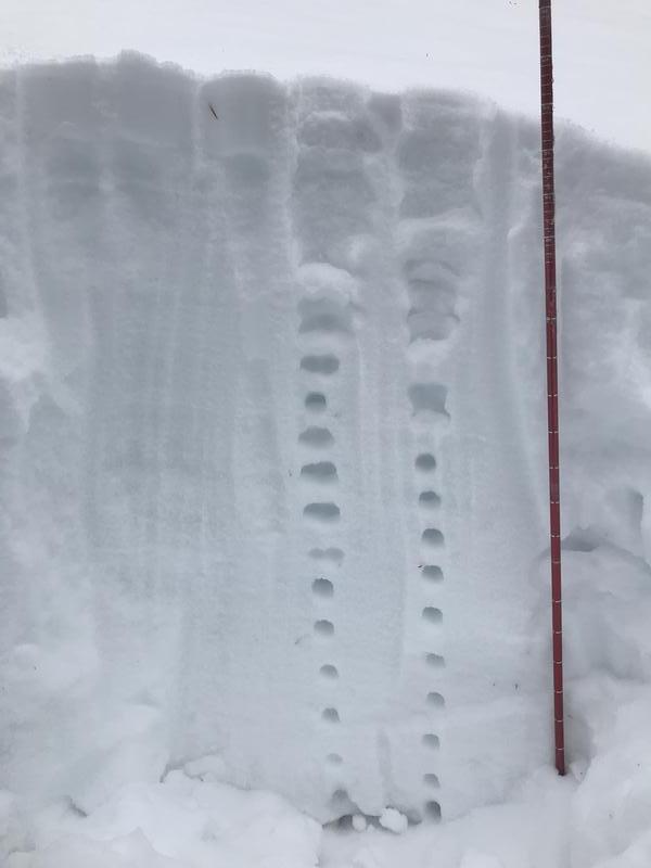
We toured in Huntington Canyon today at elevations ranging from 8,400 feet to 10,100 feet. Travel was primarily on NE, N, and NW aspects. I think I covered most of the pertinent info above but I do have a couple comments about the general snowpack in this part of Huntington. I was up in the same area last evening (Saturday, 2-23) and found a pretty strong snowpack in most areas (see photo below.) Snow depth in this area is currently in the 150-170 cm range and is very consolidated below the new snow (which is still very unconsolidated in areas that were sheltered from the wind.) There are some areas that seem to have shallower and weaker snow but overall these areas don't seem very large or connected. I would also think that if there was lots of weak snow prevalent in these areas we would have seen larger and more connected avalanches on steeper slopes today. That being said, we traveled in a pretty small area today and I'd be hesitant to commit to any steep slopes in Huntington without doing some digging and checking for weak snow knowing the history and generally shallower snowpack in these areas. It's also worth noting that many of the slopes in Huntington end in steep terrain trap features where even a small avalanche could bury someone very deeply and these slopes warrant extra caution, especially after large loads of snow like today.
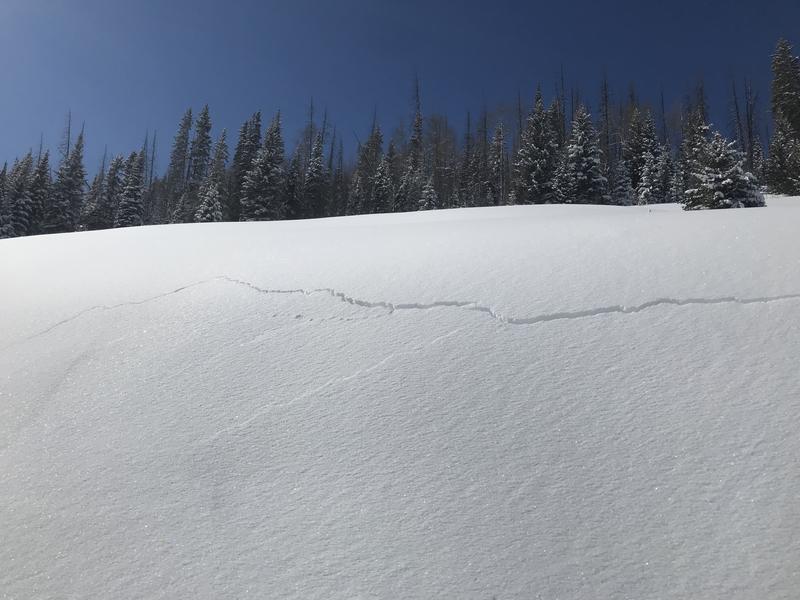
Photo 1: Cracking in new snow on a small test slope
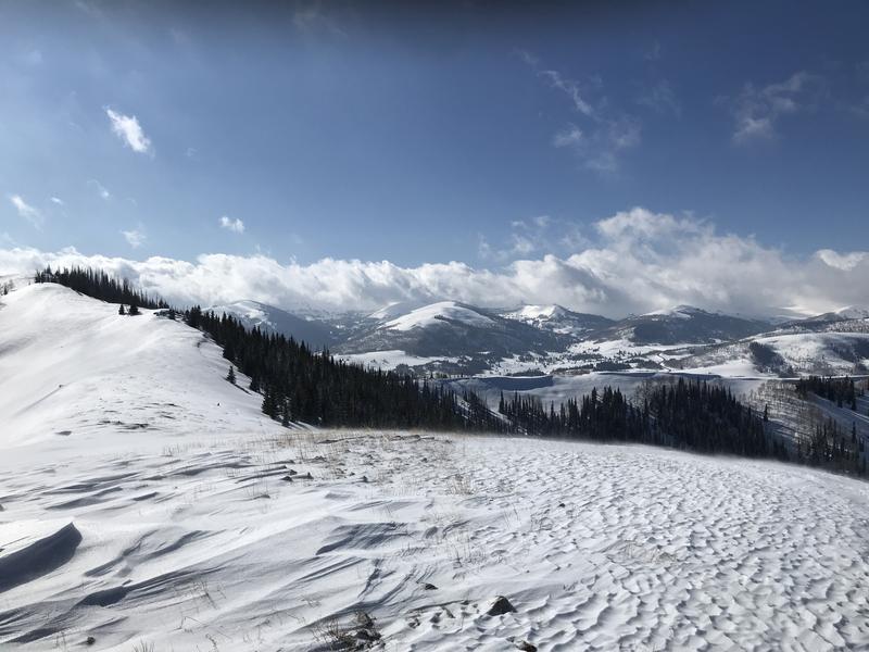
Photo 2: West aspects stripped of new snow, loading on east aspects
Photo 3: Snowpit from yesterday (Saturday 2-23) on a NW aspect, 9,300 feet.
Today's Observed Danger Rating
Considerable
Tomorrows Estimated Danger Rating
Considerable
Coordinates