Observation: Murdock Pk

Observation Date
2/17/2020
Observer Name
Brackelsberg
Region
Salt Lake » Mill Creek Canyon » Murdock Pk
Location Name or Route
Murdock Peak
Weather
Sky
Clear
Wind Direction
Northwest
Wind Speed
Light
Weather Comments
Beautiful day. Clouds moved in around 2pm, the wind picked up and temps dropped a bit.
Snow Characteristics
New Snow Depth
12"
New Snow Density
Low
Snow Surface Conditions
Powder
Snow Characteristics Comments
There was a slight wind crust 10 cm below the snow surface. I assume this was a mid-storm wind layer. This wasn't super strong, but you could definitely feel it break as you broke trail.
Red Flags
Red Flags
Wind Loading
Poor Snowpack Structure
Red Flags Comments
I was most interested in if there was going to be a slab on top of our crust and if this would be reactive. As expected there was weak snow above and below the Dickens Crust. The weak layer above the crust did not have enough of a slab on it to produce an ECT results. Our ECT result was when we collapsed the crust onto the weak snow below it.
Avalanche Problem #1
Problem
Persistent Weak Layer
Trend
Same
Problem #1 Comments
The poor snowpack structure is still my biggest concern in this area. All ingredients for an avalanche were present except for having a slab.
Avalanche Problem #2
Problem
Wind Drifted Snow
Trend
Same
Problem #2 Comments
We mostly avoided wind loaded terrain today, but you could see significant wind loading on east facing leeward slopes.
Snow Profile
Aspect
Northeast
Elevation
8,800'
Slope Angle
23°
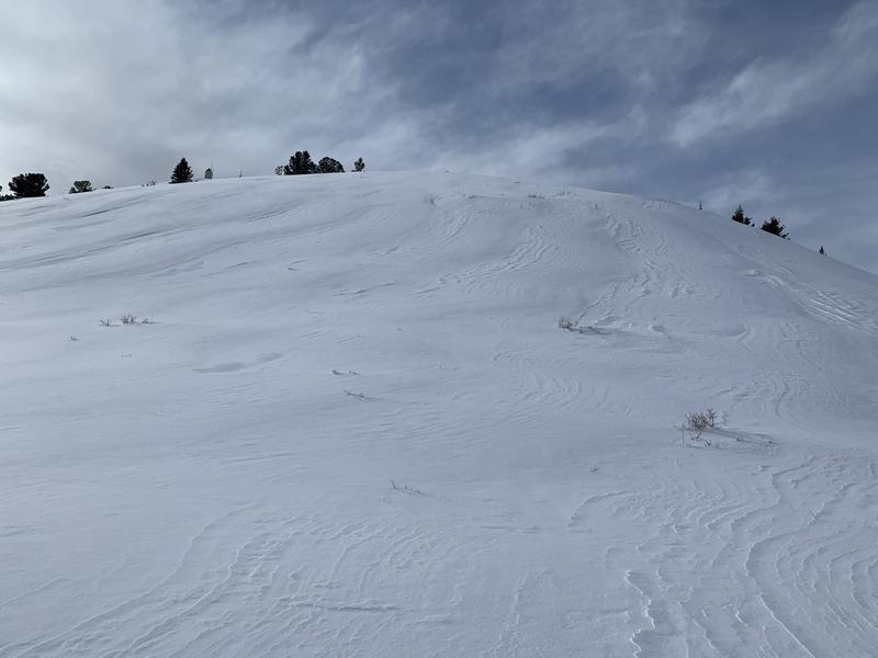
Significant ridgeline wind loading.
Today's Observed Danger Rating
Moderate
Tomorrows Estimated Danger Rating
Moderate
Coordinates