Forecast for the Provo Area Mountains

Drew Hardesty
Issued by Drew Hardesty on
Monday morning, February 10, 2020
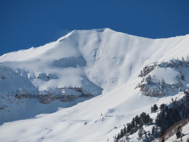
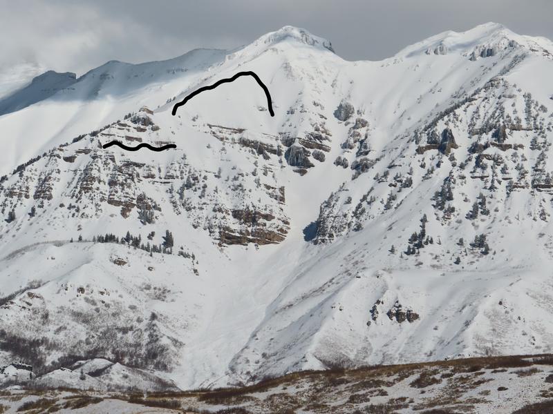
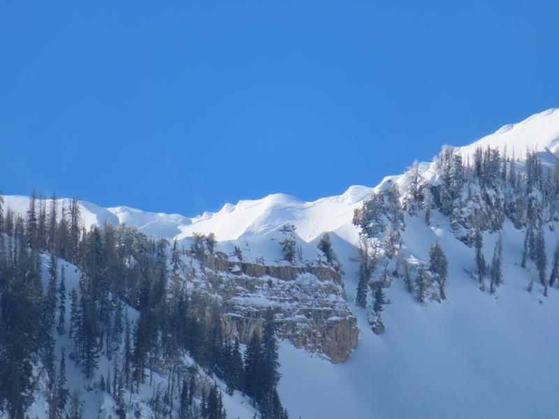
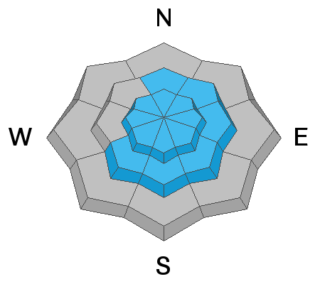
A MODERATE DANGER exists for human triggered avalanches 1-3' deep, particularly in steep wind loaded terrain. Human triggered avalanches are possible. We are trending toward LOW but we are not there yet.
Cornices along the ridgelines should also be approached with great caution. These may break off and trigger dangerous avalanches below.
Low
Moderate
Considerable
High
Extreme
Learn how to read the forecast here
Special Announcements
Discounted lift tickets - Thanks to the generous support of our Utah ski resorts and Ski Utah, all proceeds from these ticket sales go towards paying for avalanche forecasting and education! Get your tickets here.
Looking to improve your avalanche skills? We are offering a Backcountry 101: Introduction to Avalanches class at Powder Mountain February 14-15.
Weather and Snow
Skies are mostly clear with temperatures in the teens. The northwest winds picked up in the past few hours, blowing 15 with gusts to 20. The highest elevations have gusts to near 50 and the direction will veer from northwest to northeast today/tonight. Skiing and riding conditions are generally fast and easy.
A weakening storm is expected around Valentine's Day that may provide a couple inches of snow.
Recent Avalanches
Photos of avalanche activity along Timpanogos and the Cascade ridgeline during the late week's storm (courtesy UDOT). These were upper elevation wind loaded terrain; some perhaps triggered by natural cornice fall.
Ad
Avalanche Problem #1
Wind Drifted Snow
Type
Location
Likelihood
Size
Description
Wind drifts - both new and old - remain the primary concern in the Provo mountains. The old ones are becoming increasingly stubborn, but they are not dormant. They are more prominent in the upper elevations but also noted to the lee of exposed mid-elevation ridgelines. They'll be more prominently found on steep north to east to south facing terrain; even cross loaded on some southwest facing slopes. The new ones will be shallow but more sensitive in the upper elevations and exposed ridgelines of the mid-elevations.
General Announcements
This information does not apply to developed ski areas or highways where avalanche control is normally done. This forecast is from the U.S.D.A. Forest Service, which is solely responsible for its content. This forecast describes general avalanche conditions and local variations always occur.