March Kicks Off Our Spring Campaign- Donate Now to Support Forecasting

Observation: Uintas

Observation Date
2/7/2020
Observer Name
Ted Scroggin
Region
Uintas
Location Name or Route
Gold Hill
Weather
Sky
Obscured
Precipitation
Light Snowfall
Wind Direction
West
Wind Speed
Moderate
Weather Comments
Another day of moderate to strong winds and light snowfall. The drive to and from the trailhead this week has been a good barometer of what the conditions in the back country are. The winds have been steady since Monday although the snow totals have been a little on the lighter side, but the large wind drifts look like it has been snowing heavy.
Snow Characteristics
New Snow Depth
12"
New Snow Density
Medium
Snow Surface Conditions
Powder
Wind Crust
Rain-Rime Crust
Damp
Snow Characteristics Comments
Fairly high to moderate density snow and upside down conditions made for less than ideal riding and all the blistering winds have scoured down to the old hard tracks in many places. Hard to tell how much actual snow has fallen this week, with the winds blowing everything around.
Red Flags
Red Flags
Wind Loading
Cracking
Red Flags Comments
I only saw very limited terrain today, but all the boxes could easily be checked and would think things were going off up higher with many natural avalanches.
Avalanche Problem #1
Problem
Wind Drifted Snow
Trend
Same
Problem #1 Comments
Dense heavy snow and strong winds this week have likely created very sensitive snow conditions with naturals certain and human triggered slides very likely.
Avalanche Problem #2
Problem
Persistent Weak Layer
Trend
Increasing Danger
Problem #2 Comments
This long duration storm would certainly overload any thin weak snow pack areas and once the dust clears, I would think there will be some avalanche crowns to view.
Comments
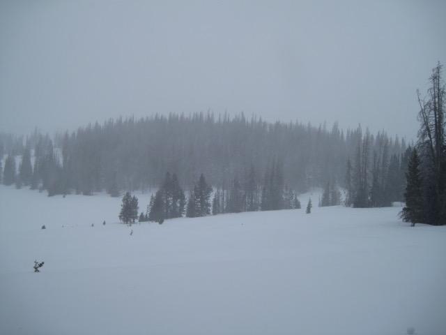
This has been the weather for a few days this week, with strong gusty winds, higher density snow and on and off snow fall, all adding up to a high avalanche danger.
The snow conditions currently are somewhat inverted with the first wave of snow this week coming in very cold and low density and now this current higher density snow on top making for dense and slabby snow. In very protected places out of the wind the snow is a little better.
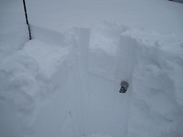
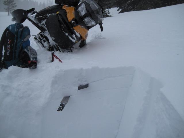
Even though I did not get any good test results in this snow pit, it was easy to identify the different layers and densities from the stormy weather this week. There is not much of a slab in this location, but in the higher terrain where more snow and very strong winds have put a dense heavy slab on these layers. The old snow surface about a foot down which is the cold low density snow from early in the week could likely fail with all the snow and water weight.
Today's Observed Danger Rating
High
Tomorrows Estimated Danger Rating
High
Coordinates