

Observation Date
2/7/2020
Observer Name
Peter Donner
Region
Salt Lake » Mill Creek Canyon » Porter Fork
Location Name or Route
Porter Fork
Comments
Toured West Porter yesterday and today (Fri 2/7). This is an update to my ob from yesterday in West Porter.
Today’s tour was up West Porter with a lap between about 8000 and 9000 and then exiting into Main Porter from West Porter Pass at 9400.
Today’s weather was less miserable than yesterday’s, though I did use my rubberized rain coat and did add a layer underneath as the day progressed. Little wind and snow during the day. Mild gusts maybe an inch of mixed graupel, dendrite and rime.
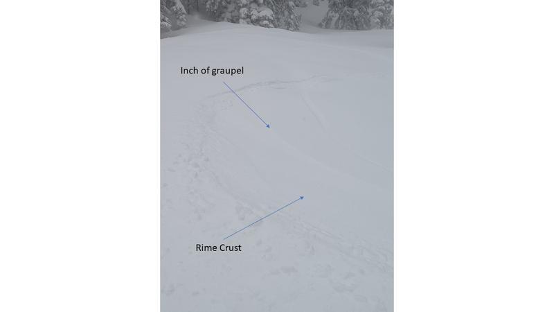
Upper Parley’s snotel at 8353 reported 10 inches of snow and 1.8 inches of water between 2/6 7am and 2/7 3pm, as of Friday 5pm. This is indicative of West Porter where I’m going to say at 9000 feet the Thurs/Fri storm added 1 foot of snow and 2 inches of water. The storm snow is divided between 10 inches averaging 10 percent density underneath an inch thick rime crust, topped off with an inch of grauple/dendrite/rime during the day Friday.
There was standing water at the trailhead at 6000 feet at the start and finish of my tour today, with an inch or two of snow/slush between Thursday and Friday morning. Seemed like the rain/snow line was around 7000 feet during the day Friday.
Didn’t bother w snowpack assessment as it was too damp and chilly to spend time digging in the snow; did a few pole probes to confirm my thinking. At 9000 feet in West Porter, the Sunday 2/2 surface sits under about 18 inches of light density settled and compacted snow from the cold storm Monday 2/3, which sits under the above described Thurs/Fri storm snow. The most important feature is the inch thick rime crust on top which seems to be locking the storm snow in place. So there is about 30 inches total on top of the Sunday 2/2 surface: 18 inches light density from Monday underneath 12 inches heavy from the Thurs/Friday storm.
Only red flag during the day Friday was very minor cracking while breaking trail, which was minor due to the you guessed it inch thick rime crust. I checked the heavy snowfall redflag because 2 inches of water in 36 hours seems like it needs to be considered, but as mentioned above snow during the day Friday was light. Didn’t check wind as there wasn’t much of it Friday and, based on the fact I was in West Porter Thurs, wind didn’t seem to have effected the snow much during this storm in the locations I visited.
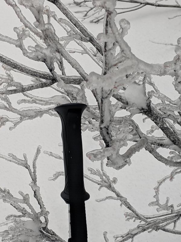
First photo is ice on shrubbery at about 8300 in West Porter.
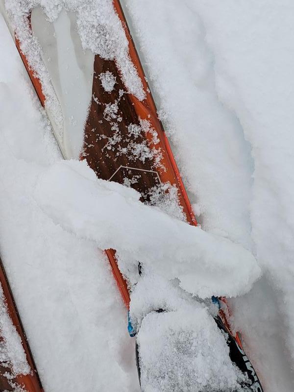
Second photo is inch thick rime crust at about 8800 in West Porter.
Third photo is turn on supportable crust at about 9100 in West Porter.
Supportable rime crust made skiing today more fun than yesterday.
Today (Fri 2/7) it seemed like avalanches were somewhere between possible and likely in Porter Fork. As mentioned, the inch thick rime crust seems to have locked the pack down and limited the effect of wind transport. Seems like a person would need to be in places like the steep paths of Gobblers or Peaks 9661 and 9776 to trigger an avalanche. So I’m calling the hazard during the day considerable; emphasizing this is for Porter Fork which is generally less than 9500 feet and seems to have had less wind and snow than the Cottonwoods.
NWS forecast for upper Porter Fork is little snow and light wind overnight Friday into Saturday. If this verifies I’d expect avalanches to be somewhere between possible and likely in steep terrain in Porter Fork so I checked considerable hazard for Saturday.
Today's Observed Danger Rating
Considerable
Tomorrows Estimated Danger Rating
Considerable