UDOT PLANNED AVALANCHE CLOSURES!!

Observation: Broads Fork/Mill B

Observation Date
2/5/2020
Observer Name
Bill Nalli
Region
Salt Lake » Big Cottonwood Canyon » Broads Fork/Mill B
Location Name or Route
Broads Fork - Mill B
Weather
Weather Comments
OVC sky through mid day until light snowfall began at 2pm. Cold in AM but we could feel the warm air moving in by mid morning. Light northwest wind.
Snow Characteristics
Snow Characteristics Comments
Snow surface was settled powder in most sheltered locations. Closer to ridges and in more exposed spots there was noticeable wind effect at the surface but not much of a new slab.
Snowpack is deep and stable in most areas surveyed. 180cm at bottom of Bonkers, 237cm top of Diving Board, 130cm W facing Mill B ridge. There is a series of crusts on W aspects below the newest snow but none were reactive to stability tests. On an east facing slope at 9600', I found a melt-freeze crust with small faceted grains underneath, below 35cm of settled snow from Monday. Stability tests suggest its bonded well to the new snow but I did get CT21 RP and ECTN 25 below the crust. Not alarming but it really was the only weakness I saw anywhere I poked into the snow.
Snow Profile
Comments
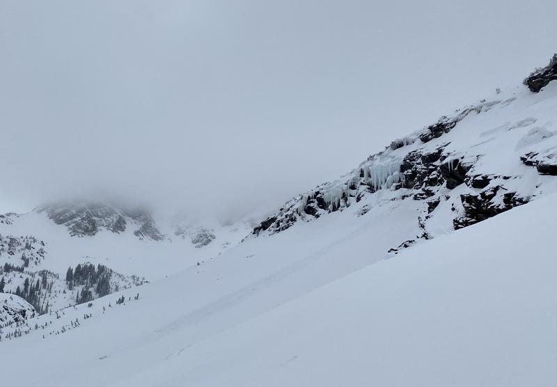
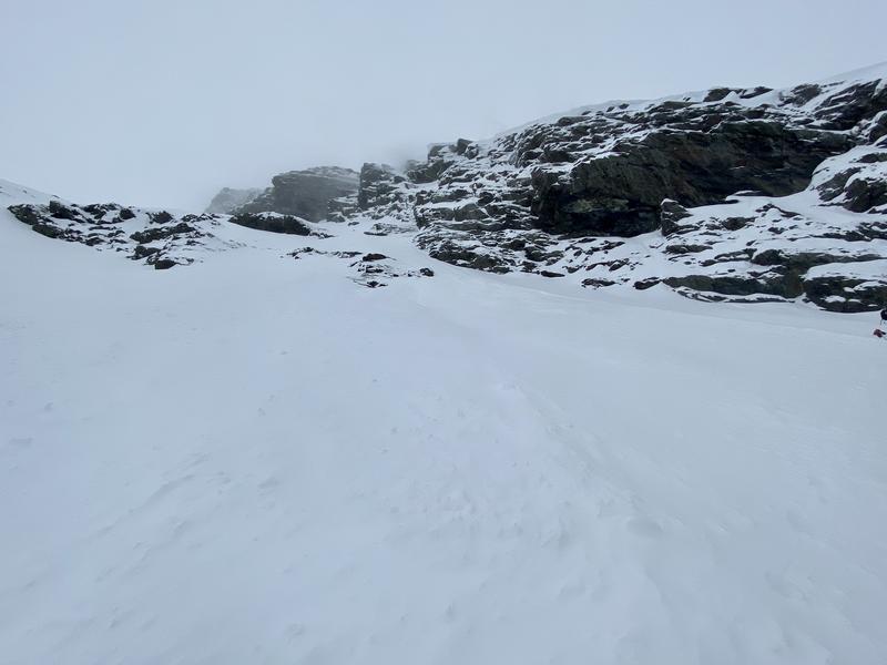
I noticed two small avalanches today. One was at the Blue Ice where a small piece of ice fell and entrained loose snow into a D1 slide. This looked to have failed late Monday or early Tuesday (pic 1). The other was a newer loose snow slide from the steep hanging snow pockets above the Diving Board. Also a D1, this slide was likely triggered by wind late Tuesday (pic 2).
Today's Observed Danger Rating
Low
Tomorrows Estimated Danger Rating
Moderate
Coordinates