


Observation Date
2/5/2020
Observer Name
John Mletschnig
Region
Uintas
Location Name or Route
Boundary Creek
Comments
Just emerged back from a trip in the Boundary Creek area 2/2-2/5.
2/2 Was etremely warm with Highs at Lily Lake(9100') 48 F. It was also very windy with strong SW moving lots of snow around and huge banners in the alpine). We dug around and noted a very weak snow surface on protected slopes with 15cm of developed NSF. We also dug at 10K, N, 33 deg. ECTP23 on 4F Depth hoar at 20cm above ground- below P harness slab. (HS 140cm)
2/3 It snowed about 6" in total. Winds shifted from SW to NW to N and were light to moderate during the storm. Primary stability concerns were still on the NE slopes where windspead hard slabs developed from pre frontal winds. Temps dipped to -12F late.
2/4 Clear, cold day with light NE winds. Started skinning at 0930 at -7F. High was around 3 deg at 9500'. Low at around 2100 was -19F under clear skies. Clouds came in early am 2/5
2/5 Trace of new snow overnight and overcast at 0700 with cloud ceiling 10200'. ~5 F and Calm.
Nearly a 70F temp swing 2/2-2/4. wow.
Overall little instabilities observed in new snow as it just didnt snow that much. Primary concern with coming storm lies in at NSF layer down 15cm from surface now.
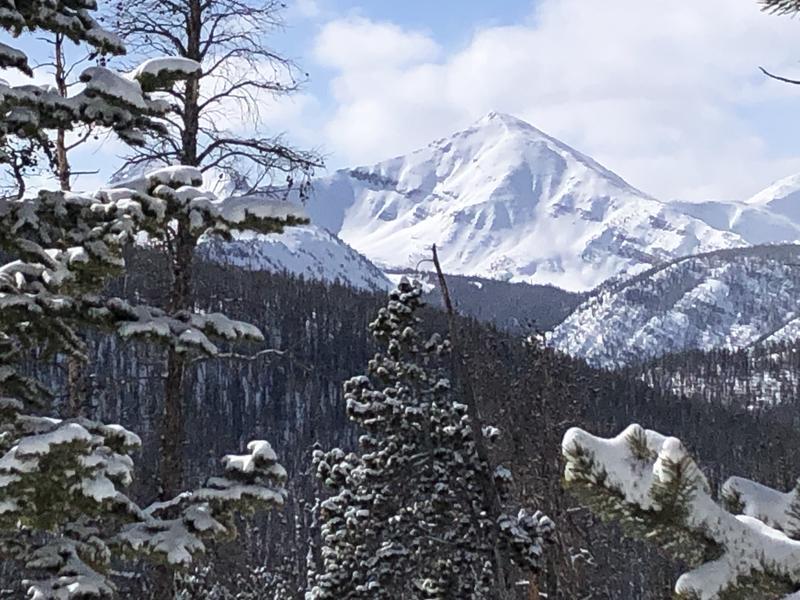
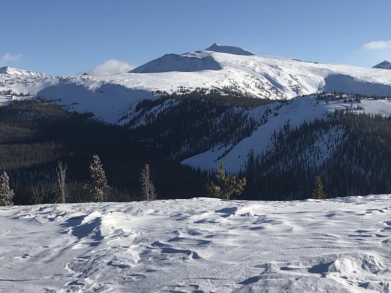
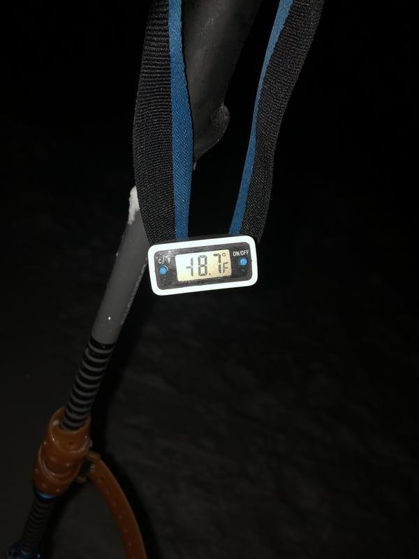
All photos from 2/4
1st: Loaded NE Face of A1
2nd: Looking at the wind hammered westerlies on the East Fork Bear/West Fork Blacks Fork Divide with Mt. Tokewanna distant.
3rd: Wind hammered alpine in upper Boundary Creek
4th: Coldest observed temp: 2100, 2/4 9520'.

Today's Observed Danger Rating
Moderate
Tomorrows Estimated Danger Rating
Considerable
Coordinates