


Observation Date
1/28/2020
Observer Name
Greg Gagne
Region
Salt Lake » Big Cottonwood Canyon » Cardiff Fork
Location Name or Route
Cardiff Fork
Comments
Storm snow sensitivities have settled out, and a few pits I dug in wind-sheltered terrain were all ECTN. Shovel tilt tests were not producing any clean shears. I was finding a few sensitive wind drifts that I was able to ski cut, and trigger small class 1 slides. Wind drifts do appear to be settling out, and will likely be less sensitive on Wednesday. Any new storm should bond well to existing snow surface.
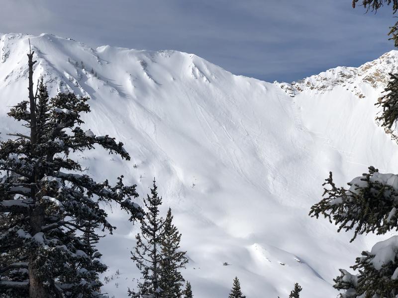
With some clearing early this morning it was apparent we went through a natural cycle Monday. There were widespread sluffs in storm snow and shallow storm slabs evident. Photo is from Cardiac Ridge.
Today's Observed Danger Rating
Moderate
Tomorrows Estimated Danger Rating
Moderate