

Observation Date
1/26/2020
Observer Name
Champion
Region
Ogden » Ben Lomond » Rodeo Ridge
Location Name or Route
Above Rodeo Ridge
Comments
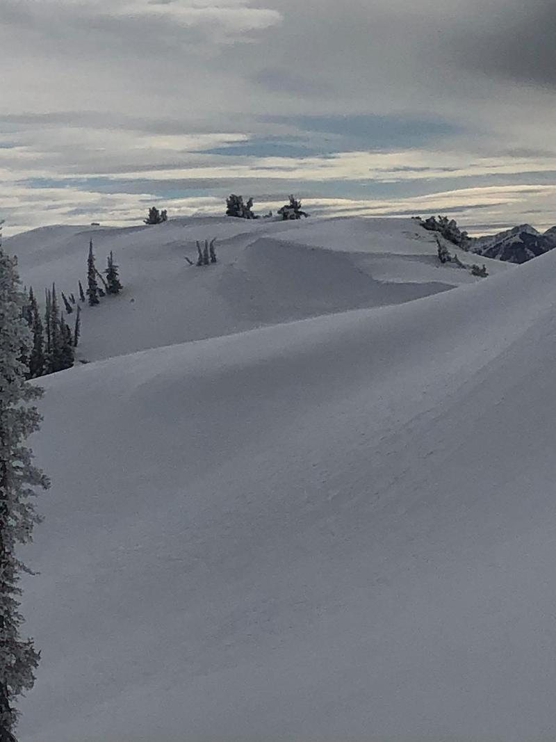
Went out today looking for signs of wind drifted now, size of cornices and what the snow surface looks like before we get a storm moving in. While we did see signs of wind drifted snow today, and could see some snow being transported, we didn't get any obvious signs of instability such as cracking, whomping, or results from ski cuts. We did see one cornice on the ridgeline heading towards Chilly peak, which recently appeared to fall naturally. Otherwise, all other cornices on that ridgeline were still intact.
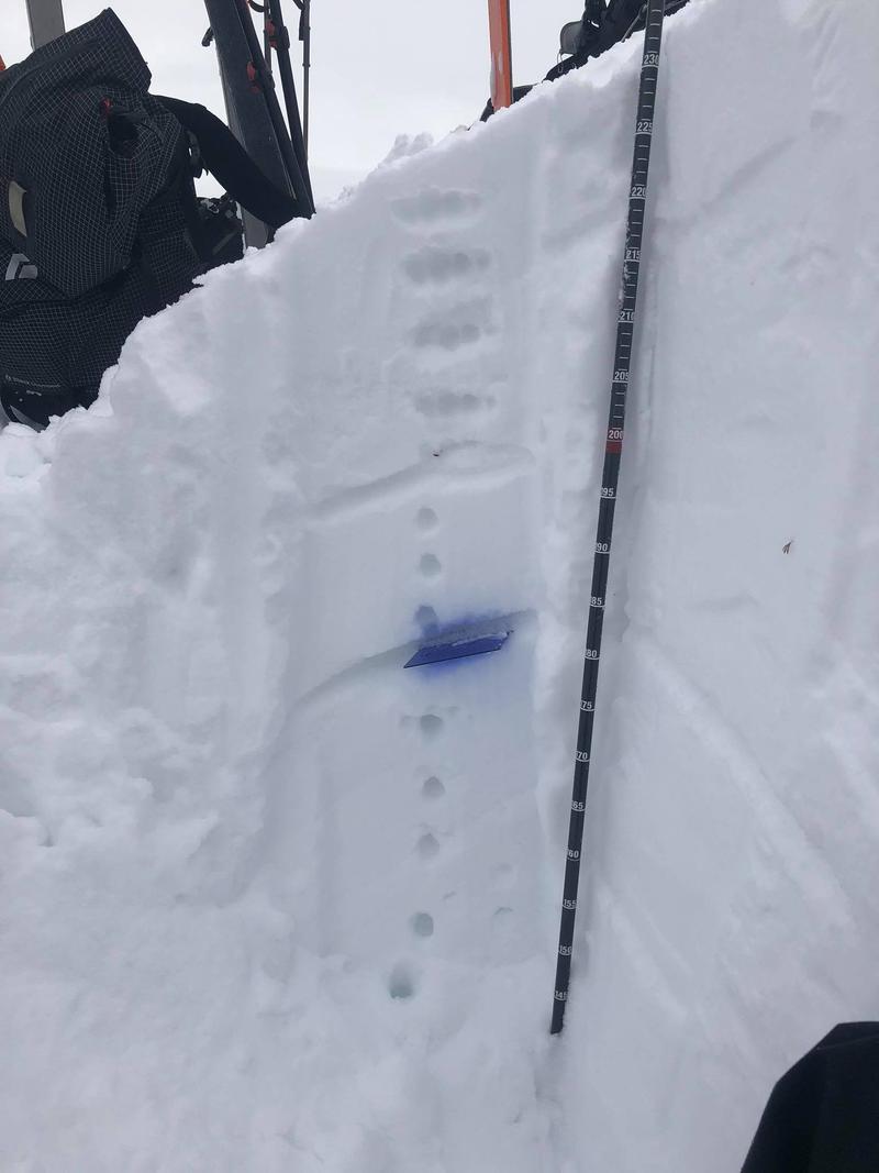
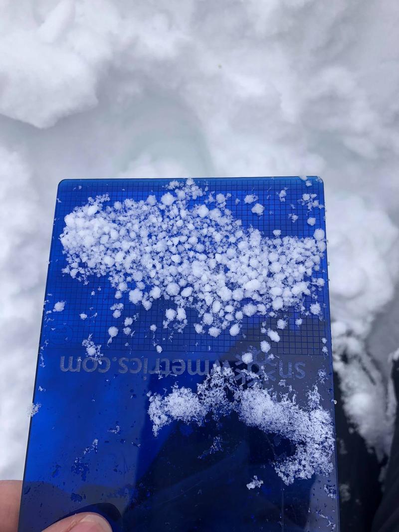
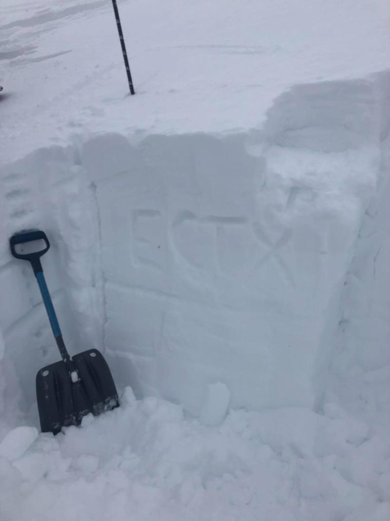
On a northern aspect at 8600' we stuck our shovels in and found a primarily right side up snowpack, with the snowpack depth being 230cm. The only layer that I was curious about when looking at the pit wall, was a 2cm layer of graupel still intact at a depth of 83-85cm in the snowpack. When we performed stability tests, we were unable to get any results on that layer.
Photo of cornice fall, ridge looking towards chilly peak, pit profile, graupel layer and pit results.

Today's Observed Danger Rating
Low
Tomorrows Estimated Danger Rating
None