Observation Date
1/25/2020
Observer Name
Ted Scroggin
Region
Uintas
Location Name or Route
Whitney Basin
Weather
Sky
Broken
Wind Direction
Southwest
Wind Speed
Moderate
Weather Comments
Mostly cloudy start to the day with nice sunshine in the afternoon. Temperatures stayed a little cool and winds on the ridge tops kept things chilly.
Snow Characteristics
New Snow Depth
3"
New Snow Density
Medium
Snow Surface Conditions
Powder
Wind Crust
Snow Characteristics Comments
A few new inches from yesterday and overnight and the small storms from the past week have added up making for great conditions. Many old tracks have filled in and the conditions around Whitney are looking good with nice supportable snow.
Red Flags
Red Flags
Wind Loading
Red Flags Comments
Just some wind issues on the exposed ridge lines, blowing the new snow around, but was not seeing any real wind drifts that were a concern. I only tested some smaller slopes for any wind drifts and did not get any great results, but higher on the more exposed ridge lines I think there would be the possibility of getting a shallow soft wind slab to break from the weight of a person.
Avalanche Problem #1
Problem
Wind Drifted Snow
Trend
Same
Problem #1 Comments
If a person went looking for a wind slab I think they are some areas where you could trigger a shallow soft wind drift on the higher more exposed ridge lines. Todays light to moderate winds from a southerly direction were enough to move the fresh snow onto north and mainly east facing slopes.
Avalanche Problem #2
Problem
Persistent Weak Layer
Trend
Same
Problem #2 Comments
The snow pack is looking deep and stronger, but there are those areas where the the snow pack is thin on steep and rocky terrain and these would be places where some of the weaker layers could produce a bigger avalanche.
Comments
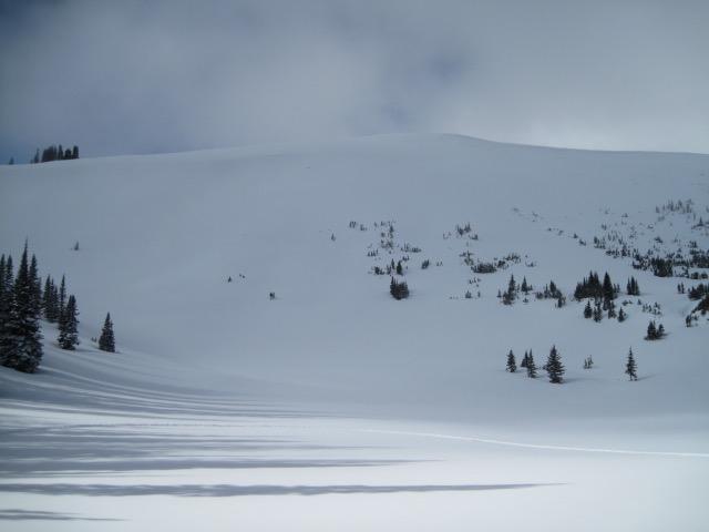
The coverage around the Whitney area is looking real good where slopes that had brush sticking up through the snow is now nearly covered and much of the terrain looks white and filled in.
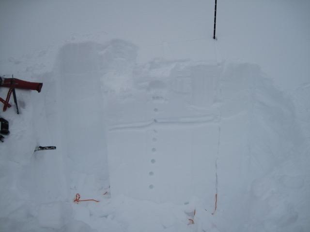
Where I dug today, the snow pack is nice and deep and getting stronger with right side up snow. Maybe some slightly lighter density snow buried a couple feet down, but no alarming test results from this layer.
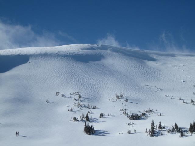
This textured look is a good clue to winds blowing across the slope from left to right creating some localized wind drifted snow.
Today's Observed Danger Rating
Moderate
Tomorrows Estimated Danger Rating
Moderate
Coordinates