Observer Name
Eric E
Observation Date
Wednesday, January 22, 2020
Avalanche Date
Wednesday, January 22, 2020
Region
Salt Lake » Big Cottonwood Canyon » Kessler Peak » Gods Lawnmower
Location Name or Route
God’s Lawnmower
Elevation
9,600'
Aspect
North
Trigger
Skier
Depth
6"
Width
50'
Comments
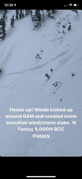
We descended God's Lawnmower from about 350-400 ft below the summit, at one of the more open access points from Patterson's Ridge. Small 2-4" pieces of soft, mostly unconsolidated new storm snow had shown signs of cracking on the skin track, and running for a few feet as stuffs on the old NE facing firmer base/crust.
After a ski cut did not release a similar soft snow slab in the main part of the route, we descended a steeper gully in the middle of God's with no issue and then pulled right into the skiers right gully at about 9600 ft. Once more, we descended without issue, this time on less steep terrain (30-33 deg).
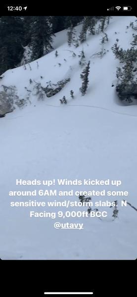
About 10-15 minutes later, a party of two descended to the skiers right of our initial track (but on top of the second portion of our descent--after we were free and clear). With a purposeful kick/ski cut on a steep, convex roller (40+ deg) they were able to fairly easily trigger a soft slab about 6" in depth that propagated 50 ft wide and ran for ~100-150 ft, covering our earlier tracks below. The slab ran mostly as sluff and the debris totaled 12" at maximum depth--not large enough to bury someone, but could take them for a ride in an area with complex terrain.
A good reminder of the localization of these wind/storm slabs and how while a ski cut in one area might not be able to release a slope, a ski cut in higher angle terrain above may be able to release just enough to for a pull out what is below. In the less steep terrain below, this issue was isolated to a short, low consequence run out at low speed/energy, but higher up on the line where the pitches are more sustained, a similar slab could have run for longer and with more speed. Overall, this small slide mirrors several other reports from the Central Wasatch today and is an indication that the new snow from Tuesday into Wednesday may not yet be bonding well with the old surface.


Coordinates


