Observation: Kessler Slabs

Observation Date
1/13/2020
Observer Name
Grainger, Young
Region
Salt Lake » Big Cottonwood Canyon » Kessler Peak » Kessler Slabs
Location Name or Route
Kessler Slabs
Weather
Sky
Obscured
Precipitation
Moderate Snowfall
Wind Direction
Southwest
Wind Speed
Light
Weather Comments
Band of moisture with the morning frontal passage, colder temps and light-moderate winds on ridges through the morning.
Snow Characteristics
New Snow Depth
3'
New Snow Density
Low
Snow Surface Conditions
Powder
Snow Characteristics Comments
Overall incredibly inactive, the 2-4' of this last week's snow through Sunday is low-density with very little wind effect. Some dry loose activity from higher PI rates and cornice fall were evident in steep start zones like God's Lawnmower but no slab development or new/old interface instabilities in our travels. Sluff was very manageable and moderate-length running.
The 2"-4" snow associated with this morning's frontal passage was the only layering issue we noted throughout the day. While only a subtle density change in sheltered areas, exposed areas showed the beginnings of (soft) wind-slabbing throughout the morning. These were easily triggered on subridges with limited propagation. With continued wind, another layer of snow tomorrow then more wind in days to come, I think we'll see increasing slab formation and activity.
Red Flags
Red Flags
Heavy Snowfall
Wind Loading
Avalanche Problem #1
Problem
Wind Drifted Snow
Trend
Increasing Danger
Problem #1 Comments
Winds will affect the current new snow layers, increasing transport, wind slab formation and propagation. Transport plumes were visible off areas of the Cottonwoods, Millcreek, and PC ridgelines by afternoon.
Comments
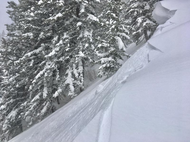
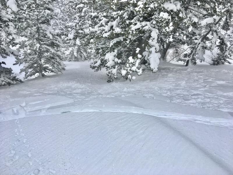
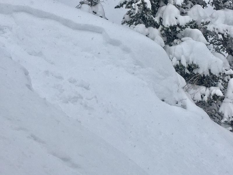
This morning's density change with wind effect. Small and soft wind slabs now but I think sustained winds will enhance this problematically in the coming days.
Today's Observed Danger Rating
Considerable
Tomorrows Estimated Danger Rating
High
Coordinates