Observation Date
1/10/2020
Observer Name
Meisenheimer
Region
Salt Lake » Big Cottonwood Canyon » Mineral Fork
Location Name or Route
Mineral Fork
Comments
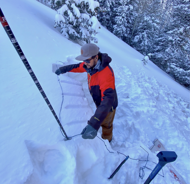
I dug four snowpits from the elevation of 7,800' to 9,300'. All four pits revealed a weak layer of snow roughly buried 2' deep depending on the elevation. This is the same layer Mark Staples is seeing in the Ogden area as well as Drew Hardesty from the Meadow Chutes area the other day. Only the upper two snowpits allowed for propagation. One was on a northeast facing slope at 8,900' and the other was on an east facing slope at 9,100' in elevation (no crusts were present). Both snowpits had test scores of ECTP 23.
I believe this weak layer formed between the Christmas and the New Years period where we had very light snow and cold temperatures. Below is a video showing where this layer failed in the snowpack. While this layer is producing results in our snowpit tests - We are yet to see human or natural triggered avalanches on this layer. I am not sure what it means. But, it's something to keep an eye on and continue looking for especially with more water (snow) and wind in the forecast.

Video
Today's Observed Danger Rating
Moderate
Tomorrows Estimated Danger Rating
None


