Greg Gagne
Forecaster
Our Week in Review highlights significant snowfall, weather, and avalanche events of the previous week. (Click here to review the archived forecasts for the Salt Lake mountains.)
The danger roses for the Salt Lake mountains from Friday, December 20 through Thursday, December 26, 2019:

Summary: Warming temperatures and sustained winds out of the south through early in the week. Snowfall begins late Monday afternoon, persisting through Wednesday. Storm totals are:
- 15" in the Cottonwoods (highest amounts of mid Big Cottonwood canyon)
- 10" along Park City ridgeline
Avalanche activity within storm snow on Wednesday.
Friday, December 20: No backcountry avalanches reported, with warming temperatures and increasing southerly winds.
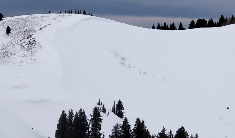
Saturday, December 21: Continued warming temperatures and southerly winds. A natural avalanche in South Monitor bowl along Park City ridgeline likely occurring overnight. This was on a repeater slope and had been wind-loaded, likely failing on a persistent layer of weak faceted snow down near the ground. (Observation).

Sunday, December 22: Sustained southerly winds create pockets of hard wind drifts. A skier in Rocky Point (along Catherine's Pass backcountry between Alta and Brighton) triggers a wind slab and was able to ski out of the slide (observation). In the Ogden mountains a skier triggers a hard wind slab and deploys airbag while being buried up to their armpits. The slope angle measured 31 degrees.
Monday, December 23: Continued southerly winds. No backcountry avalanches reported. Snowfall begins with a period of heavier snowfall in the Cottonwoods by late afternoon, with 2-4" reported.
Tuesday, December 24: Reports of cracking in wind-drifted snow. Continued snowfall with an additional 3-6". Southerly winds, which had been blowing strongly for the past 72 hours, begin to subside.
Wednesday, December 25: Snowfall overnight and into Wednesday with long-running sluffs in the storm snow. The most notable & dramatic avalanche occurred on Dutch Draw in the backcountry adjacent to the Canyons:
All observations from Wednesday can be found by clicking here.
Thursday, December 26: Instabilities in the surface snow largely settle out, but sluffing on very steep aspects is still reported.


