

Observation Date
12/6/2019
Observer Name
mark white
Region
Salt Lake » Big Cottonwood Canyon » Cardiff Fork
Location Name or Route
Cardiff Fork, Cardiac Area
Comments
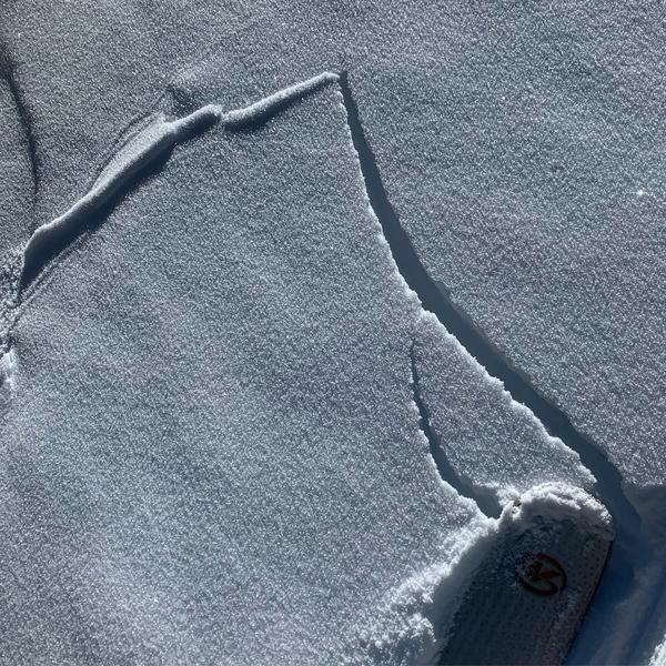
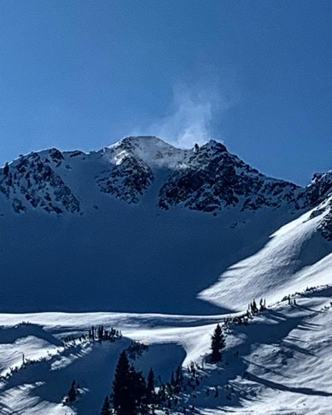
Today I went up to the Cardiac area in Cardiff Fork, we hiked up from the BCC side to avoid the steep N facing entry’s from LCC which still has poor structure. Yesterday’s moist weather has settled last weeks storm snow into a fairly stiff and dense slab with only 4 inches ski penetration while hiking and skiing. At this point in time digging snow pits seems kinda pointless, if you turn your pole upside down and shove it down through the pack and it goes into loose faceted garbage at the bottom that’s poor snowpack structure with a dense slab on top and skiing slopes with this sort of structure that are steep enough to avalanche is still risky, if you shove your pole into the pack and and it gradually gets denser on the way down to the dirt then there is no underlying weak layer and most likely is much less likely to avalanche. The high N and NE still are harboring this poor structure and should be looked at as suspect and now that the slab is denser and more cohesive getting caught in a slide would most likely not have a good outcome. I did experience some cracking in the new snow but no collapsing. There’s quite a bit of surface hoar on the N end of the compass but it will most likely be destroyed be pre-frontal winds and warm temperatures before Sunday’s storm.
photos: cracking in the new snow, surface hoar and wind transport on Superior
Today's Observed Danger Rating
Considerable
Tomorrows Estimated Danger Rating
Considerable