

Observation Date
12/1/2019
Observer Name
Greg Gagne
Region
Ogden » Snowbasin Backcountry
Location Name or Route
Snowbasin backcountry
Comments
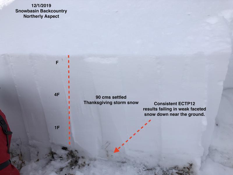
Traveled through unskied terrain in Snowbasin backcountry, focusing on the snowpack on northwest through northeast aspects between 8000-9000'. Big-picture, take-home points from today:
- The Thanksgiving storm snow has turned into a cohesive slab with F-hardness at the surface, down to 1F at its base;
- instabilities within storm slab from the recent storms are rapidly settling out;
- weak, faceted snow and depth hoar down near the ground on mid and upper elevation slopes facing northwest through northeast is a concern.
Details below.
Overall on slopes other than at the mid and upper elevation aspects facing northwest through northeast, conditions are quickly stabilizing with the snowpack gaining strength.
Biggest concern is on slopes generally above 8000' facing northwest through northeast where there is weak faceted snow and depth hoar down near the ground. It seems avalanche activity was failing within storm snow weaknesses over the past several days, but with the storm slab settling and gaining strength, the weakest snow on these northerly aspects is down near the ground.
Dug 4 pits today, with generally consistent results:
- Pit #1 8400 NW aspect ECTP26 down 55 cms failing on facets
- Pit #2 8800' NE aspect ECTP12 down 60 cms failing on facets
- Pit #3 8300' N aspect ECTP12 down 90 cms failing on facets
- Pit #4 8200' N aspect ECTP12 down 60 cms failing on facets.
While excavating pit #3, we got a very loud collapse.
Consistent pit results make me very uncomfortable on steep northerly aspects where there is weak snow down near the ground.
Hazard rating is difficult, as most of the terrain has a Moderate to Low hazard. I also think the *probability* of triggering a deeper slide on the facets/depth hoar down near the ground is decreasing, but given the consequences, I would avoid all slopes steeper than 30 degrees facing northwest through northeast above 8000', so would call that hazard Considerable.
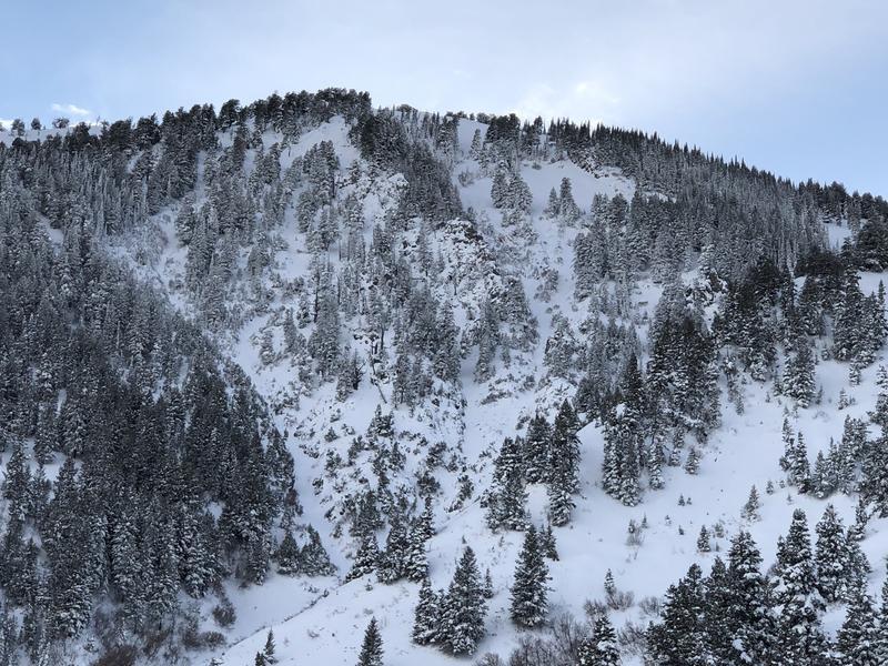
Video and photos from today:
- general pit profile showing strong slab over weak snow down near the ground.
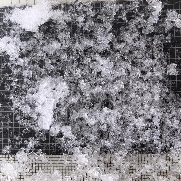
- 3-5 mm striated depth hoar crystals down at the ground.
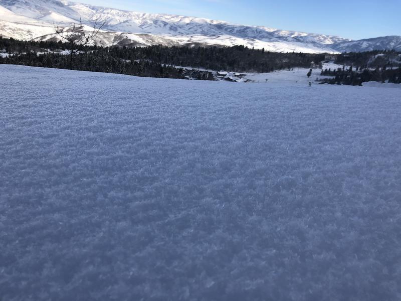
- Developing surface hoar found on sheltered low and mid elevations.
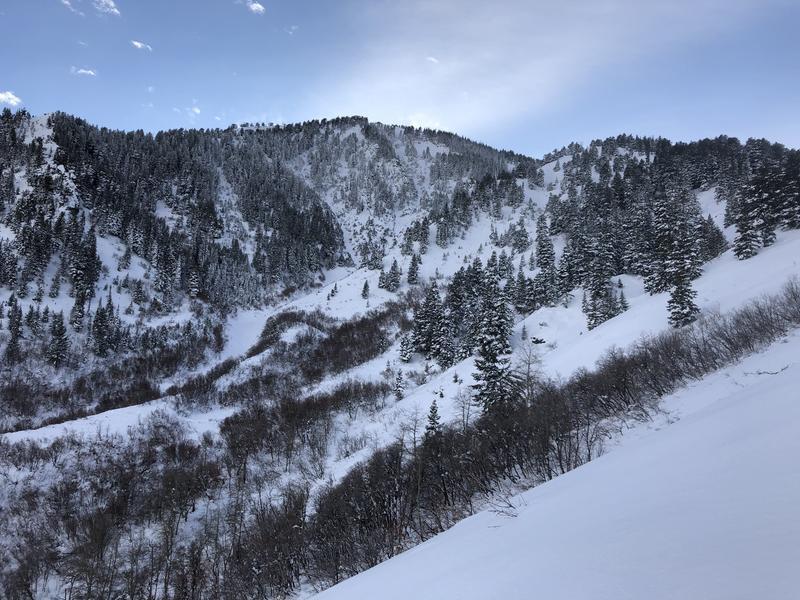
- Upper reaches of Hells Canyon
Video
Today's Observed Danger Rating
Considerable
Tomorrows Estimated Danger Rating
Considerable