Join us for the 17th Annual Professional Snow and Avalanche Workshop (PROSAW) on November 4 - Purchase tickets here!

Forecast for the Moab Area Mountains

Eric Trenbeath
Issued by Eric Trenbeath on
Monday morning, November 25, 2019
Last week's storm brought the first measurable snow to the La Sal Mountains. There isn't enough coverage for winter recreation and there is currently very little threat for avalanches. That will likely change this week with an active pattern ahead. Snow depth currently ranges from only a few inches at the Geyser Pass Trailhead to 8" in Gold Basin, and I'm estimating a foot or more above 11,000'. Avalanche danger will start to become present in some areas when we see about 18" of snow on the ground. I'll be updating the forecast regularly this week, and will begin issuing danger ratings when conditions warrant. Expect the danger to rise over the next several days.
Low
Moderate
Considerable
High
Extreme
Learn how to read the forecast here
Special Announcements
The First Annual Avalanche Awareness Week is December 2-7 We have a week full of fun and educational events planned. Check out the schedule here.
The annual free Know Before You Go avalanche awareness talk will be held at the Grand County Library on Thursday, Dec 5 at 6:00 p.m. Hope to see you there!
Weather and Snow
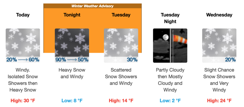
Two storms are on track to affect the region this week. The first system is already moving into northern Utah. This system will favor the northern mountains but it should track into our area by tonight and I'm anticipating 3" -5" by tomorrow morning. The next system is a little more exciting and should be similar to what we saw last week. This storm will move into our area on Wednesday with snow likely lasting through Friday.
Storm totals at Gold Basin Study Plot (10,000').
Snotel site near Geyser Pass Trailhead (9600').
Ad