icon-add
Observation
Menu
×
Menu
Forecasts
Logan
Ogden
Salt Lake
Provo
Uintas
Skyline
Moab
Abajos
Weather
Archives
How to read the forecast
Observations & Avalanches
Submit Observation
Observations Explorer
All Observations
Avalanches
Fatalities
Weather
Place Names Map
Archives
Education
Avalanche Class List
UAC Class List
Online Classes
Resources and Tutorials
Avalanche Awareness
Develop Skills
Events
Store
About
Contact
Who we are
Core Values
Staff
Board of Directors
Past Forecasters
Sponsors
Annual Reports
Sign In
Blog
Donate / Join
Search
Forecasts
Logan
Ogden
Salt Lake
Provo
Uintas
Skyline
Moab
Abajos
Weather
Archives
How to read the forecast
Observations & Avalanches
Submit Observation
Observations Explorer
All Observations
Avalanches
Fatalities
Weather
Place Names Map
Archives
Education
Avalanche Class List
UAC Class List
Online Classes
Resources and Tutorials
Avalanche Awareness
Develop Skills
Events
Store
About
Contact
Who we are
Core Values
Staff
Board of Directors
Past Forecasters
Sponsors
Annual Reports
Sign In
Blog
Menu
Search
icon-add
Observation
Donate / Join
Submit Observation
Observations Explorer
All Observations
Avalanches
Fatalities
Weather
Place Names Map
Archives
Submit Observation
Observations Explorer
All Observations
Avalanches
Fatalities
Weather
Place Names Map
Archives
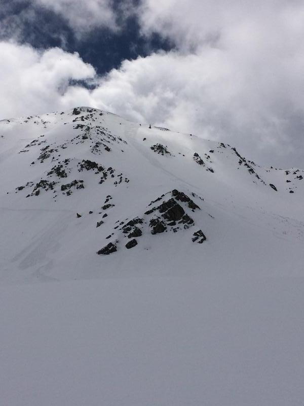
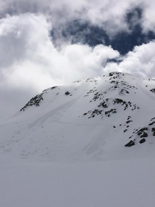
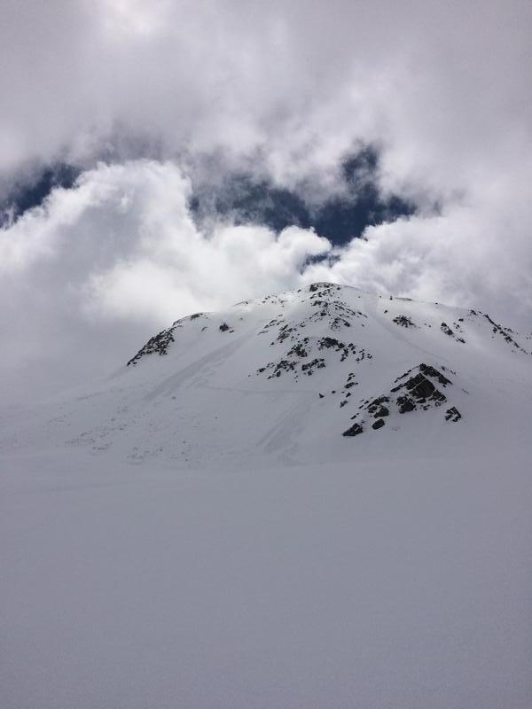
Observation: White Pine Gulch
Observation Date
5/1/2019
Observer Name
CBrown
Location Name or Route
Red Pine White Pine
Weather
Sky
Broken
Precipitation
Light Snowfall
Wind Direction
Northwest
Wind Speed
Light
Weather Comments
Sun was mostly covered during the morning with a few quick breaks, then becoming more SCT after 13:00. Light NNW wind on the top of White Baldy around 11:00. S-1 snow showers on and off during the morning.
Snow Characteristics
New Snow Depth
5"
New Snow Density
Low
Snow Surface Conditions
Powder
Melt-Freeze Crust
Snow Characteristics Comments
HST 4"-10". Little Slabby on W-NW where the wind was able to get on it. Still cold and light through the day above 10k.
Red Flags
Red Flags
Recent Avalanches
Cracking
Rapid Warming
Red Flags Comments
Had cracking all morning on the wind affected snow. When the sun did pop it heated up quickly. Snow below 9,500' was noticeably affected by the short sun breaks despite the cool temps. Unintentionally triggered R1 D1 slab at about 10,600' on one of the NNE shots off lake peak while skiing. Area had wind fetch and some of the deeper snow of the day. Did not occur right at the steeper convexity where I expected but a few turns lower.
Avalanche Problem #1
Problem
Wind Drifted Snow
Trend
Decreasing Danger
Problem #1 Comments
Soft wind slabs noted on N-NE. Also had some slow moving but fairly long running loose dry sluffs.
Avalanche Problem #2
Problem
Wet Snow
Trend
Increasing Danger
Problem #2 Comments
With the high sun angle the snow below 9,500 was affected by the sun but not so much by the tempatures today.
Today's Observed Danger Rating
Moderate
Tomorrows Estimated Danger Rating
Moderate