Observation: Cardiff/Mineral

Observation Date
3/31/2019
Observer Name
Bill Nalli
Region
Salt Lake » Big Cottonwood Canyon » Cardiff/Mineral
Location Name or Route
Cardiac Ridge, Mineral
Weather
Sky
Clear
Wind Direction
Southwest
Wind Speed
Calm
Weather Comments
Bluebird and crisp to start the day. Air temps rose to the upper 20's at 10'k by mid morning but the intense spring sun made things feel much warmer everywhere but the high ridgelines. High clouds began streaming in by 13:00 but did little to cool things down.
Snow Characteristics
New Snow Depth
12"
New Snow Density
Low
Snow Surface Conditions
Powder
Snow Characteristics Comments
W-S-E aspects went off yesterday and this morning had varying degrees of sun crust on them. NE-N-NW stayed cold and dry above about 9000'. Tomorrow that zone on the compass will have shrunk a bit more toward the high north. Excellent powder skiing still exists but it will be even more important tomorrow to start and end your tour early to avoid the late day melt down.
The south aspects became damp by about 10am but I think the WL instability held off until early afternoon today because of yesterday's melt freeze cycle.
Of note, a solid radiation recrystallization event happened yesterday on many east slopes above 9000', seen in both Cardiff Bowl, Cardiac Ridge and Mineral. I suspect the facets that formed at the surface will get bullied back into the crust below over the next days warming and aren't likely to become the next weak layer but its something to be aware of.
Comments
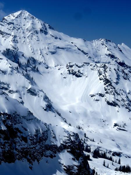
East slopes that tipped a bit more toward the South got wet yesterday afternoon and we saw many WL-D1's. Pics below are ESE aspects in Cardiac Ridge and Mill B Sidewinder.
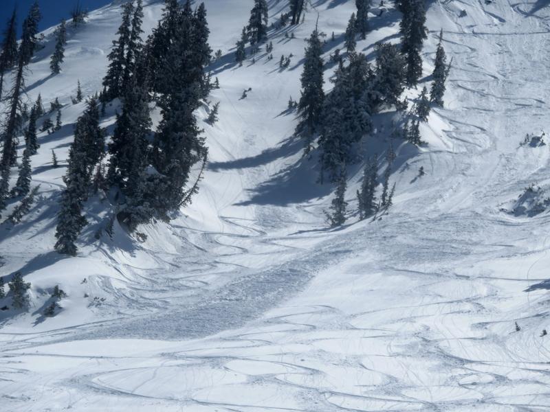
Outside of the obvious WL problem today, we encountered a similar dry LS hazard on steep continuous slopes. It was mostly easy to manage but in technical terrain could have bigger consequences. Pic below was in Mongo No, steep north facing terrain at 10'K in upper Mineral Fork.
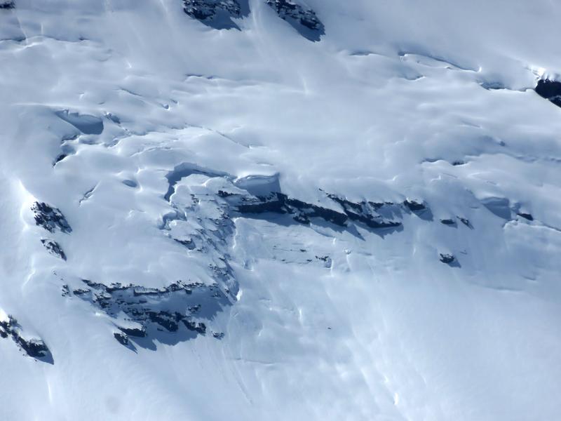
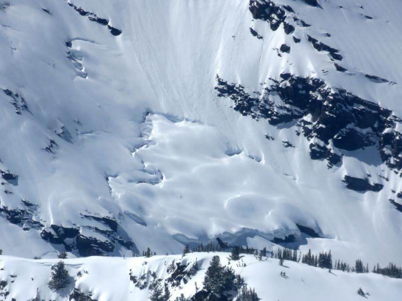
Lastly, it would be wise to pay attention to the obvious glide avalanche areas. The best defense from this hazard is avoidance this time of year. All of the glide cracks I've seen are getting very big and with this year's deep snowpack I suspect we will see some significant slides as we move into warmer days. Pics here are of the usual suspects in Broads Fork at the Blue Ice and Diving Board.
Today's Observed Danger Rating
Moderate
Tomorrows Estimated Danger Rating
Moderate
Coordinates