

Observation Date
3/28/2019
Observer Name
Greg Gagne
Region
Salt Lake » Little Cottonwood Canyon » White Pine » Lake Peak
Location Name or Route
White Pine/Lake Peak
Comments
Travel was White Pine to Lake Peak. Few interesting observations:
Generally Low hazard as clouds and wind kept the snow surface cool. Recent wind slabs were not reactive to ski cuts.
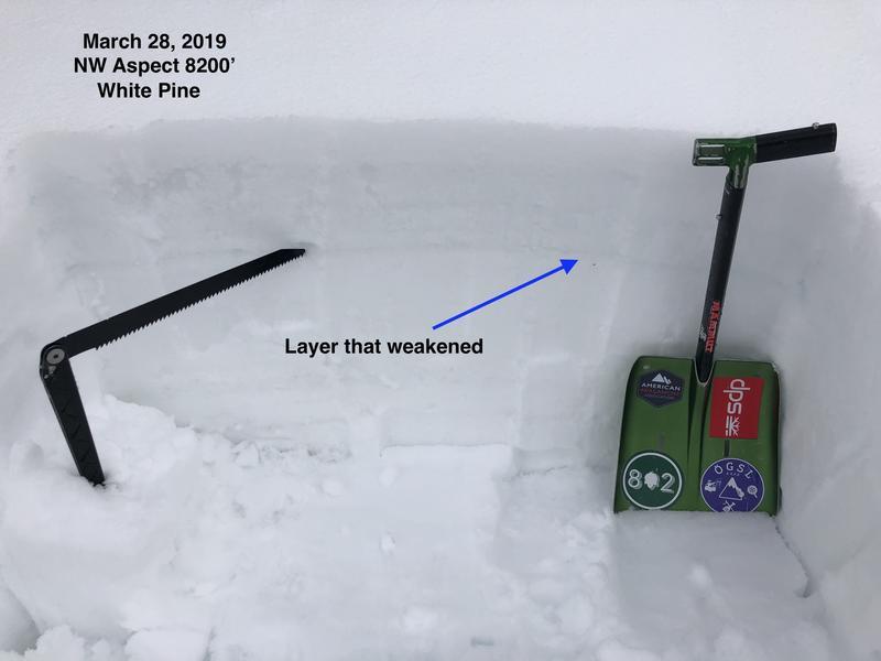
Photo below is from NW aspect at 8200' with the snow saw and blue line pointing at a gray stripe of weaker snow. Liquid water had percolated down through the snowpack, and weakened this layer, and I was able to get clean shears in the 15 cm wet slab above it. Wet slab avalanches are different than dry slab avalanches in the sense that dry slab avalanches occur because the weak layer has been overloaded. With wet slab avalanches, liquid meltwater hits a layer of snow (often above a crust) and causes that layer to weaken. Overall the snowpack seemed to have decent drainage and wet slabs are not a concern for now.
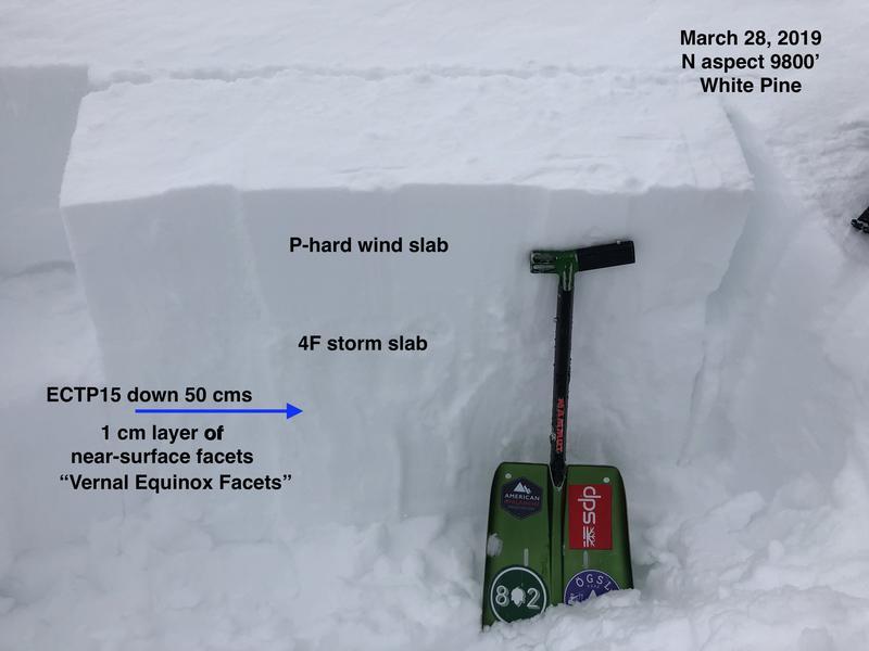
Once I got into the alpine zone above about 9500' I was finding hard wind-drifts from the last 24-48 hours of moderate to strong winds from the south/southwest. These slabs were up to 30-45 cms thick and pencil hard. They were not sensitive to ski cuts and appear to have quickly stabilized. However, one a north aspect at 9800' I did find a preserved layer of near-surface facets from earlier last week (we'll call them the "Vernal Equinox Facets" as they likely grew around March 20/21). This layer has since been covered by snowfall from March 21-24, and topped off by a wind slab from recent winds. I was able to get full propagation with extended column test, failing down 50 cms in this faceted layer. I do think this is somewhat isolated as the facets need to have been preserved, and this would have only occurred on upper elevation northerly slopes where the faceted layer would have been preserved underneath the storm snow that fell late last week.
I did move over to another northerly slope that did not have recent wind-loading but the facets had been preserved, and could only produce ECTN22, failing on this faceted layer. It seems for the slab to propagate requires having the stronger wind slab on top.
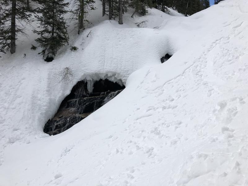
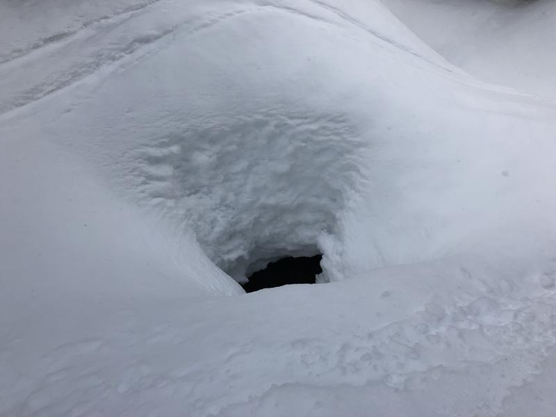
With a deep snowpack we haven't seen the creeks for quite some time, but they are now beginning to appear as the snow melts, and they create a significant hazard if one were to fall into an open hold, or a snow bridge above the creek were to collapse. These holes are 8-10' deep in places. Be watchful where you are traveling this Spring if you are in areas that involve travel on creek beds.
Today's Observed Danger Rating
Low
Tomorrows Estimated Danger Rating
Moderate