Observation Date
3/9/2019
Observer Name
Ted Scroggin
Region
Uintas
Location Name or Route
Gold Hill
Weather
Sky
Obscured
Wind Direction
Northwest
Wind Speed
Light
Weather Comments
Temperatures stayed on the cool side today with brief periods of filtered sun and light northwest winds along the ridge lines.
Snow Characteristics
Snow Surface Conditions
Powder
Snow Characteristics Comments
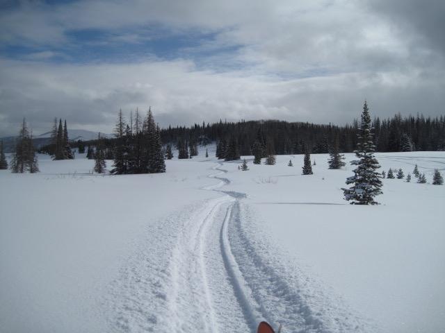
What a great storm that lasted a few days stacking up anywhere from 12-18" of nice cold light density snow in the Gold Hill Basin. The riding and turning conditions were very nice on a settled base making for over the hood and riding.
Red Flags
Red Flags
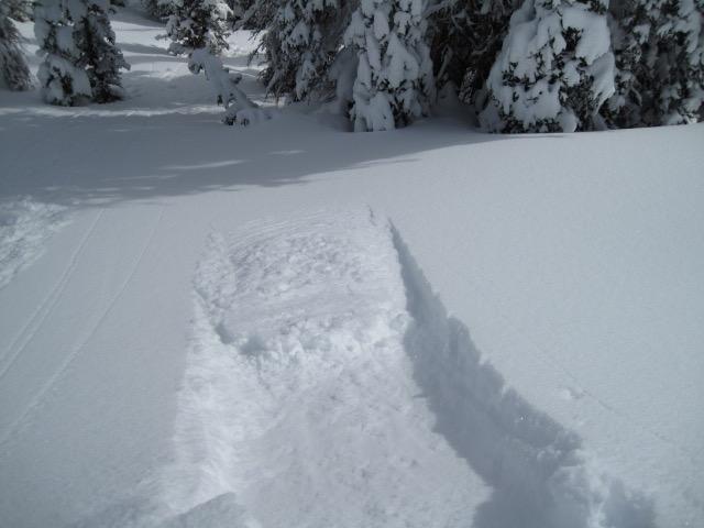
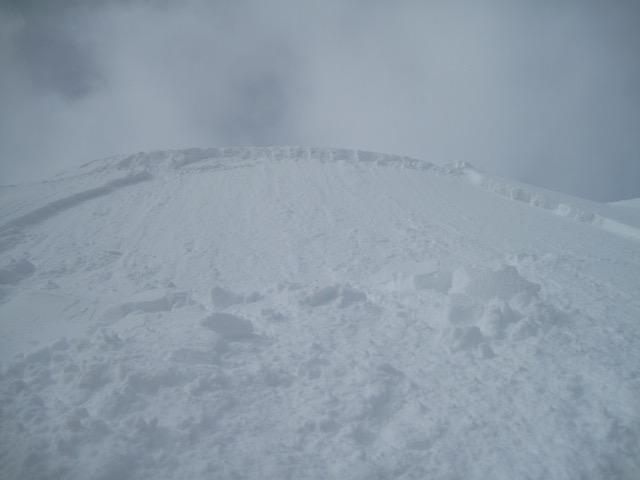
Wind Loading
Cracking
Collapsing
Red Flags Comments
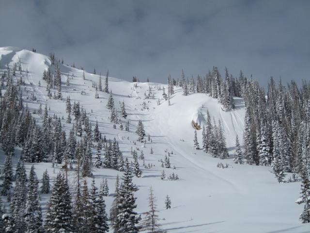
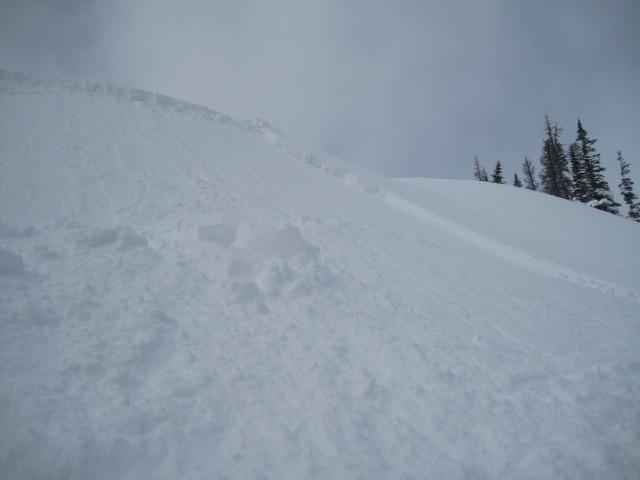
Today's red flags mainly involved the recent storm snow and some minor wind loading. I did experience one unexpected collapse, but this was in a pockety terrain feature where wind drifted snow is resting on some thinner, shallow snow possibly around a rock. Manageable surface sluffing and soft slabs of the new snow were the main concern today. These were a little touchy this morning, but seemed to relax as the day went on. Not packing a lot of punch unless you were in steep and confined terrain.
Avalanche Problem #1
Problem
New Snow
Trend
Decreasing Danger
Problem #1 Comments
The new snow instabilities should settle out quickly, but the light density snow could still be sensitive with an increase in winds tonight.
Avalanche Problem #2
Problem
Wind Drifted Snow
Trend
Increasing Danger
Problem #2 Comments
Winds today were on the light side and very minimal wind drifting, but the next storm should ramp up the wind issues tomorrow.
Comments
1. What a great storm for the Uintas, with upwards of 18" making for fun and floaty turning. 2. A few dry point releases observed in steeper terrain with cold light density snow.
1. The new light density would sluff easily in steeper terrain and pretty manageable unless you were in steep and confined terrain. 2. In more wind exposed areas, I was able to trigger these soft slabs that were up to a foot deep.
Today's Observed Danger Rating
Moderate
Tomorrows Estimated Danger Rating
Moderate
Coordinates