

Observation Date
3/9/2019
Observer Name
mark white
Region
Salt Lake » Big Cottonwood Canyon » Cardiff Fork
Location Name or Route
Cardiff Fork
Comments
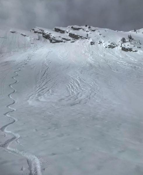
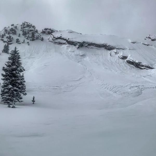
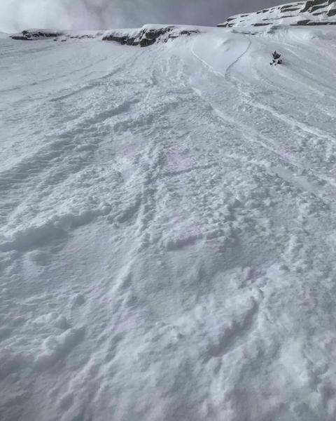
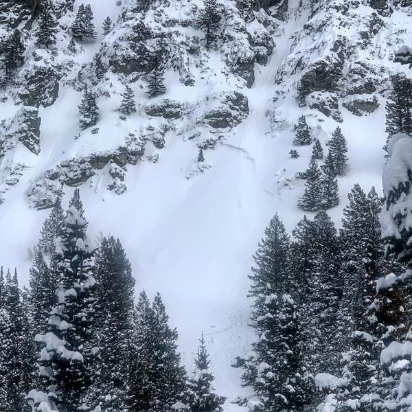
Travel today was up to Ivory Flakes via BCC, most all the steep W, N and E facing slopes on the way up had avalanched most likely yesterday during high PI rates. Some of the more notable ones that appeared to break into old snow were LSB NE facing with a crown low down on the slope some of the W facing chutes off of the Reed and Benson ridgeline which broke out in the aprons most likely due to graupel pooling, and some fairly impressive slides on the Ivory Rock Slabs that looked like new snow sluffs coming off the rock slabs triggering deeper avalanches when they hit the apron due to graupel pooling. Much of the E-NE facing slopes off of Kessler also avalanched, Shoots and Ladders, included. New snow slides on Cardiac Ridge were also evident. Things seemed pretty benign today, I think what was gonna slide already did and what didn’t slide has for the most part stabilized except for maybe some storm slabs resting on pooled graupel or some preserved light density snow from last weekend.
Photos: avalanches on the Ivory Rock Slabs, with some of the debris making it over the bench, sluffs from today on the Rock Slabs, and one of the crowns in the apron of one of the chutes off the Reed and Benson ridge line.

Today's Observed Danger Rating
Moderate
Tomorrows Estimated Danger Rating
Moderate