Observation: Upper Weber Canyon

Observation Date
3/7/2019
Observer Name
Kikkert
Region
Uintas » Upper Weber Canyon
Location Name or Route
Upper Weber Canyon
Weather
Sky
Overcast
Precipitation
Moderate Snowfall
Wind Direction
Southwest
Wind Speed
Moderate
Weather Comments
Weather had a bit of everything. Moderate snowfall in the early AM, then periods of clearing mixed with moderate snow squalls. Winds were light to moderate. Very warm when the sun came out.
Snow Characteristics
Snow Surface Conditions
Dense Loose
Snow Characteristics Comments
Storm totals of 7-10" of dense snow. A bit wet down low.
Red Flags
Red Flags
Wind Loading
Red Flags Comments
Past 2 days the biggest red flag has been wind loading. We haven't gotten that much new snow, and the winds haven't been that strong, but there has been enough of both for sensitive wind slabs on NW-E.
Avalanche Problem #1
Problem
Wind Drifted Snow
Trend
Same
Problem #1 Comments
Was able to trigger several wind slab avalanches today, primarily with cornice drops. See photos below for one example. Slabs ranged from 6 to 18" deep. They were all failing on a layer of light density snow from prior to this storm (this layer produced propagation in test pits as well...but looks like mostly decomposing fragments with very little faceting noted). Given the density of the new snow, the wind slabs were a bit more connected that would otherwise be expected with these wind speeds. Although they are expected to settle out fairly quickly, I anticipate that given a obvious "weak layer" and additional loading tomorrow, that these wind slabs will remain sensitive for at least another day.
Also, of note is that cornices are very large and sensitive. Even carefully kicking them, had a couple near rides as large blocks peeled off. They are so large an elevator drop in some cases would be 10' for more.
Avalanche Problem #2
Problem
Persistent Weak Layer
Trend
Decreasing Danger
Problem #2 Comments
Not to say this problem isn't out there...you can find it easy enough in thin rocky repeater areas. However, many areas I have been looking in have a deep snowpack with mostly strong snow.
Comments
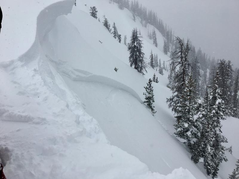
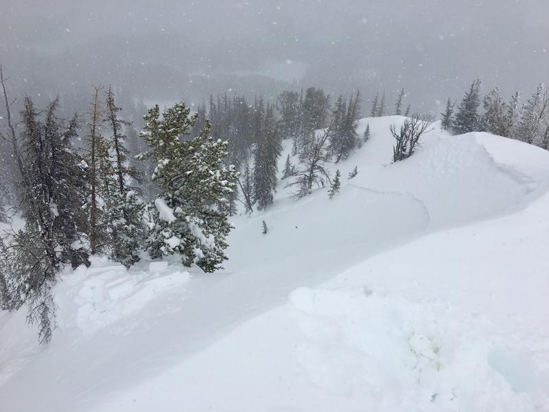
Photos below show a wind slab triggered with a cornice drop. One pic looking NW and the other NE taken from the middle of the same slide. Average depth on this one was 12" deep, with a maximum depth of 18". Ran 400' and was approximately 100 ft wide.
Today's Observed Danger Rating
Considerable
Tomorrows Estimated Danger Rating
Considerable