Observation: Big Springs

Observation Date
2/26/2019
Observer Name
Joey Dempster
Region
Provo » Provo Canyon » South Fork Provo R. » Big Springs
Location Name or Route
Right Fork of Big Springs, South Fork of Provo Canyon
Weather
Sky
Broken
Wind Direction
Southwest
Wind Speed
Moderate
Weather Comments
Moderate to strong winds swirled around the upper part of the drainage for much of the day, transporting a lot of snow. Cool enough to keep shaded snow from getting damp above 8000 feet, but below that all snow surfaces were quite damp and sticky. Wind deposited snow was widespread at all all elevations.
Snow Characteristics
Snow Surface Conditions
Dense Loose
Damp
Snow Characteristics Comments
Settled powder was abundant and skied well above 8000 feet, but wind loaded snow was frequently encountered in often unpredictable patterns. Winds were shifting and swirling all day, transporting snow in different directions. Lower elevation and sunny aspects became damp. I did not observe any significant wet activity, but the warming was strong enough to produce widespread crusts tomorrow morning below 8000 feet, and on south facing slopes at the mid elevations.
Red Flags
Red Flags
Wind Loading
Rapid Warming
Red Flags Comments
Wind loading was the primary concern today. Down off the summit ridge, wind loaded snow was on just about every roll over and lee slope, but none of it was sensitive to skiing. The higher elevation steep terrain looked to be more hazardous (and not very good skiing with all of the deposition going on) so we elected to stay off the highest terrain in favor of more sheltered slopes. While we were not able to trigger any of the wind slabs we encountered (no cracking of any note on any of the slopes that we tested or skied), I think the same would not be true at the highest, most exposed elevations.
Snow Profile
Aspect
Northwest
Elevation
9,000'
Slope Angle
35°
Comments
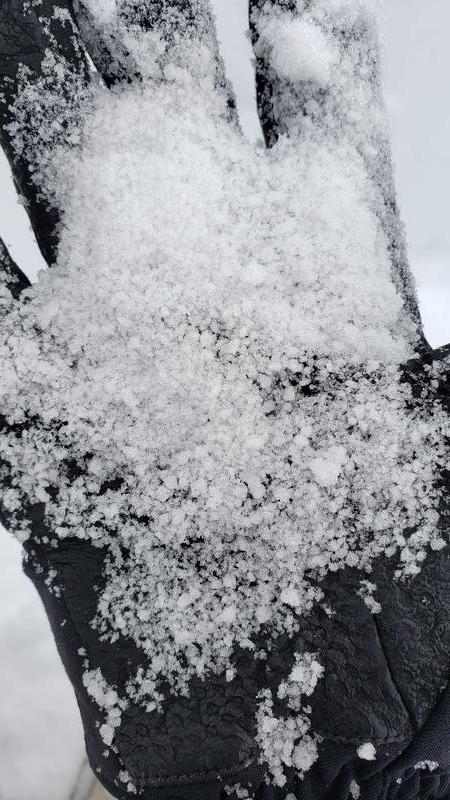
I dug down 100cm. The snow below that was all very hard and consolidated. I did not dig to the ground to check for facets. Total snow depth was 280cm. The one layer of concern was a graupel layer that was quite visible in the pit at 40cm. But it did not fail until the very last extra hard hit in an ECT (see video). The failure was a break, and Q3. While relatively weak, it is not overloaded or active at the moment. We did not find any contradictory evidence in skiing progressively steeper slopes throughout the day. There is also a detectable discontinuity at about 25cm that is probably an old snow surface, but it is also not active at the moment (see photo). I would call the hazard today moderate, but only for the possibility of wind loaded snow on the upper ridges. Sheltered areas lower with small depositions of wind transported snow have a low hazard. Large, open, high elevations slopes that may have facets are still a no-go for me because of the potential for facets at the bottom.
Video
Snow closeup is of graupel pulled from the 40cm layer (lower line in snowpit wall photo)
Today's Observed Danger Rating
Moderate
Tomorrows Estimated Danger Rating
Moderate
Coordinates