T. Matthews D. Garcia N. Ament E. Grote and K. Jones
Region
Moab
Location Name or Route
Trans La Sal to Noriega's Backside.
Comments
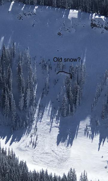
Photo: 1. The natural wind slab avalanche in Dory Canyon that likely occurred late Thursday or Friday morning during the peak winds and precipitation rates.
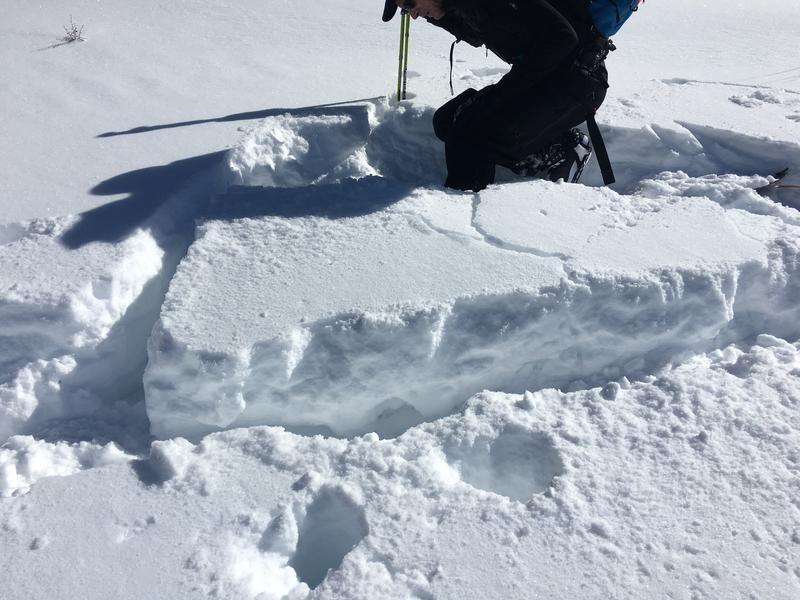
Photo: 2. Is an area of much thinner snowpack. We assumed we'd get some collapsing due to the depth and structure, and we did. I isolated a small block of snow and then did a kick turn over the top of it. With a bit of pressure the slab collapsed above the facets and cracked out. Dave Garcia grabbed the photo.
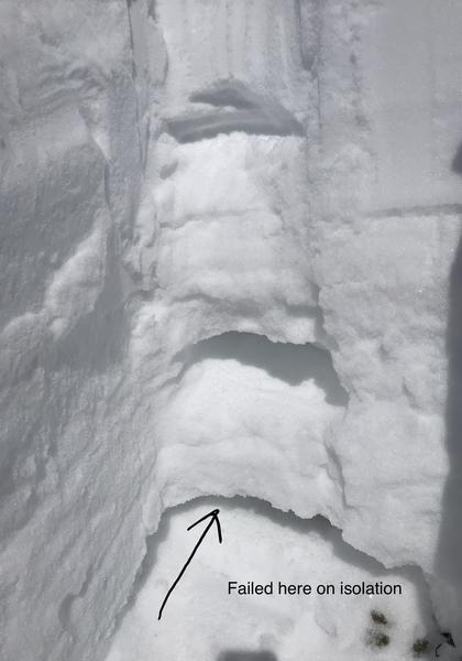
Photo: 3. We had considered getting in to a bit steeper terrain on a SW aspect. Height of snow was 110 cm. We looked at the structure really quickly and preformed two CT's on a 25 degree slope. First CT failed on facets above a crust near the ground upon isolation. The 2nd CT failed on the same facets on the 13th tap. CTM RP Q2. Sheer quality was rough, but we still weren't feeling it and bailed on that option.
I think by tomorrow we will be out of the woods for new snow avalanches. Wind drifted snow will also be less of a concern, if of course , the winds remain light. It's the persistent weak layers in the snowpack that will continue to produce avalanching. Especially in thinner areas or on slopes that have already avalanched this season. It may also, require a larger load on the slope like a snowmobile or two. I'm calling for a moderate danger for persistent weak layer avalanches for tomorrow based on the size and distribution of this problem type.
Forecaster note: This is an excellent observation and I agree with a trend toward Moderate. Storm snow problems have largely dissipated, but there are still wind drifts in the high country that could be sensitive to a skier or rider. Wind slab problems, combined with the unpredictability and destructive force that remains in the persistent weak layer problem, I'm going to keep the danger Considerable on steep, northerly facing terrain.