Observation Date
2/11/2019
Observer Name
mark white
Region
Salt Lake » Park City Ridgeline » Monitors
Location Name or Route
Monitors
Comments
Travel was up West Willow to the Monitors today, the south facing on the way up was light density powder until about 3/4 of the way where you entered the wind zone. The wind had created a layered and stiffer snow pack up high, the snow had Saturday nights light density under the denser snow from last night, for some reason the layering was much more perceptible on the S facing than the N. There was allot of snow being transported into S Monitor Bowl and I was a bit suspect of wind slabs on the old avalanche bed surface in the center punch of the slope but after ski cutting and jumping on some of the more prominent wind pillows just off the ridge it seemed that they were bonded well to the old surface with no cracking noted. W Monitor looked much less wind affected than S Monitor but it has not had the big clean out like S Monitor and I’m still suspect of the weak layers at the bottom of the pack, and was not up for testing these weak layers so soon after such a large load has been deposited, I think a little settlement time would be in order but that’s just my opinion.
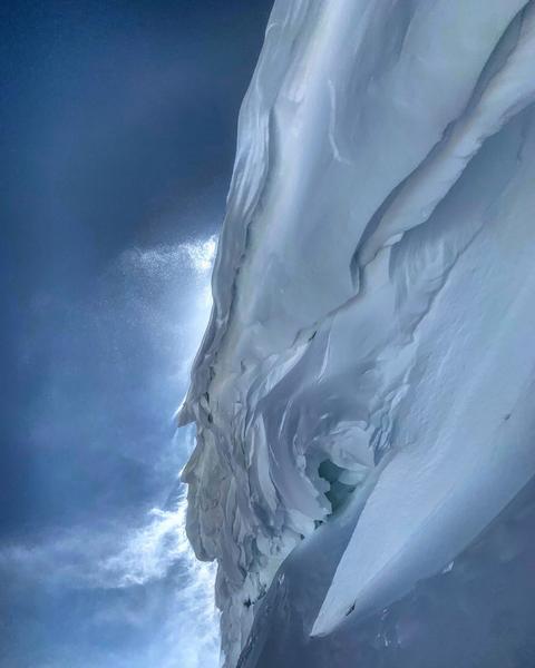
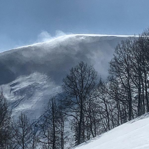
photos: cornice development in S Monitor, tried not to spend much time under this monster while ski cutting non reactive wind slabs, and increasing wind moving more snow as the afternoon wore on


Hazard depends on wind tonight if it keeps blasting I would stay at considerable if not moderate in most terrain except for the outliers with a thinner snow pack
Today's Observed Danger Rating
Considerable
Tomorrows Estimated Danger Rating
Moderate
Coordinates


