Join us at our 2nd Annual Blizzard Ball

Forecast for the Uintas Area Mountains

Craig Gordon
Issued by Craig Gordon on
Sunday morning, February 10, 2019
DANGEROUS AVALANCHE CONDITIONS REMAIN UNCHANGED ON THE EASTERN FRONT... WHAT HAS CHANGED THIS MORNING IS A FAMILY IS WITHOUT THEIR FATHER
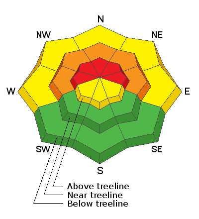
In the wind zone, at and above treeline, the avalanche danger is HIGH. Human triggered and natural avalanches are LIKELY on steep wind drifted slopes, especially those facing the north half of the compass. Any avalanche that breaks into deeper buried weak layers near the ground will result in a very scary, dangerous, and quite possibly unsurvivable avalanche that will instantly ruin your day.
You'll find CONSIDERABLE avalanche danger on steep, mid elevation, wind drifted slopes and human triggered avalanches are PROBABLE.
Strong winds have created unusual avalanche conditions in low elevation terrain where a MODERATE avalanche danger exists. Human triggered avalanches are POSSIBLE on steep slopes near our trailheads, foothills, and possibly our own backyards.
Yes, it's still sketchy out there but it doesn't mean we can't ride. Choose gentle terrain or big, open meadows with no steep terrain above, adjacent, or connected to where you're traveling. In other words.... simply stay off of and out from under steep, wind drifted slopes.
Low
Moderate
Considerable
High
Extreme
Learn how to read the forecast here
Special Announcements
Sad news to report.... again!
Yesterday, a 49 year old man was killed in an avalanche accident on the west side of Humpy Peak in the East Fork of the Chalk Creek drainage while riding with his son and a friend. I will visit the site this morning and post more details as we gather them. A preliminary investigation is found here.
In addition, 41 year old Brad Stapley of St. George was caught and killed in an avalanche east of Beaver, UT near Circleville Mountain on Friday. More details to the tragic accident are found here.
Of course the collective thoughts, prayers, and energy of the UAC go to the friends and family of these men.
Weather and Snow
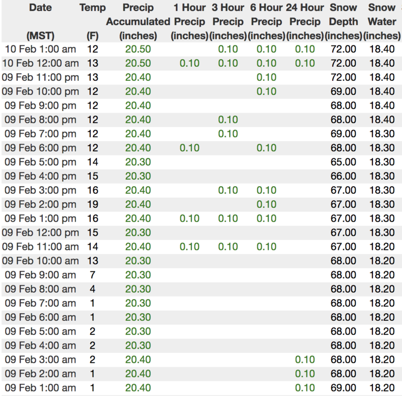
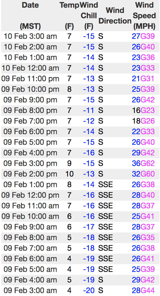
Last nights quick hitting storm delivered 4" of light density snow. In it's wake, skies are clear and temperatures in the single digits and low teens. Southerly winds continue humming along the ridges this morning and have blown consistently since Friday with hourly averages in the 30's and 40's, gusting into the 50's along the high peaks. It's a bit rugged in the high country, so lose some elevation and you'll find excellent riding conditions on low angle, low elevation wind sheltered terrain, especially on slopes facing the south half of the compass.
Above is hourly data from Trial Lake (9,945') and Windy Peak (10,662'). To view more regional weather stations click here.
Recent Avalanches
No mystery here, the Uinta's are sketchy! Multiple recent close calls reported across the range the past few days... including a very tragic avalanche accident yesterday.
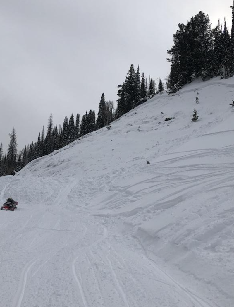
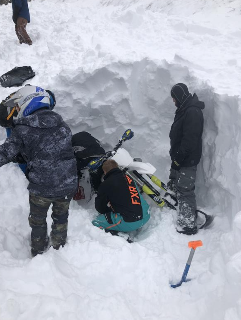
A close call in Mill Hollow as a snow biker was buried when he triggered this steep slope above the summer road. Lucky his hand was sticking out of the snow and everyone in the group was prepared for their own self rescue, quickly digging their partner out of the snow. This story has a happy ending. A first hand account with poignant take home points found here.
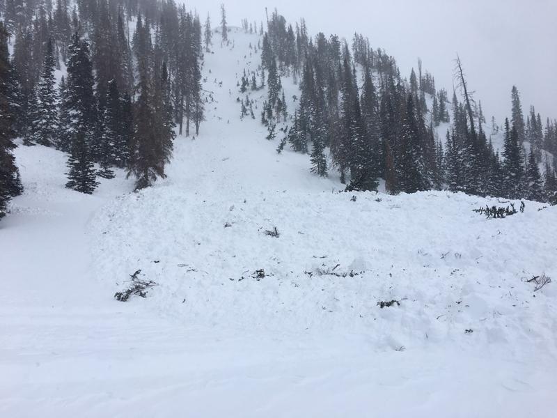
Above, a few images from yesterday's tragic avalanche accident in Chalk Creek. Triggered while the sledder was climbing, this slide broke deep and wide, taking out the entire seasons snowpack, snapping timber as it crashed down onto the slope below.
Recent trip reports and avy activity found HERE.
Ad
Avalanche Problem #1
Persistent Weak Layer
Type
Location
Likelihood
Size
Description
The wording from yesterdays' forecast remains the same, because the hazard remains the same-
Nothing has changed on this front since midweek and today's avalanche dragon still has a dangerously subtle personality. It's gonna be tricky because we can ride some slopes without incident, thinking we're good to go, but roll up to steep, wind drifted terrain that didn't slide during last weeks big storm and now we're staring down the barrel of a dangerous avalanche. However, here's what I do know and make no mistake... this is the real deal and not the type of avalanche problem that we want to tangle with or try to outsmart. Today's avalanches could still potentially be triggered mid slope, low on the slope, or from a distance. Once initiated, they'll break deep and wide and could take out the entire seasons snowpack in some locations, resulting in a potentially unsurvivable slide. That's too much uncertainty for me to deal with so I'm keeping it simple... patience and avoidance are the only solution. I'm simply gonna ride low angle terrain in the sun and avoid being on or under steep, wind drifted slopes.
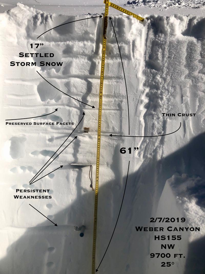
JG offers a beautifully detailed snowpit profile whilst offering some sage advice.... "Patience is your best friend right now. Play the slope angle game and stay out of the wind zone. Low angle terrain out of the wind zone offers great riding right now even with the amount of new snow we've received." He goes on to say.... "If you're traveling in the wind zone on the north half of the compass the danger is high and you should expect avalanches."
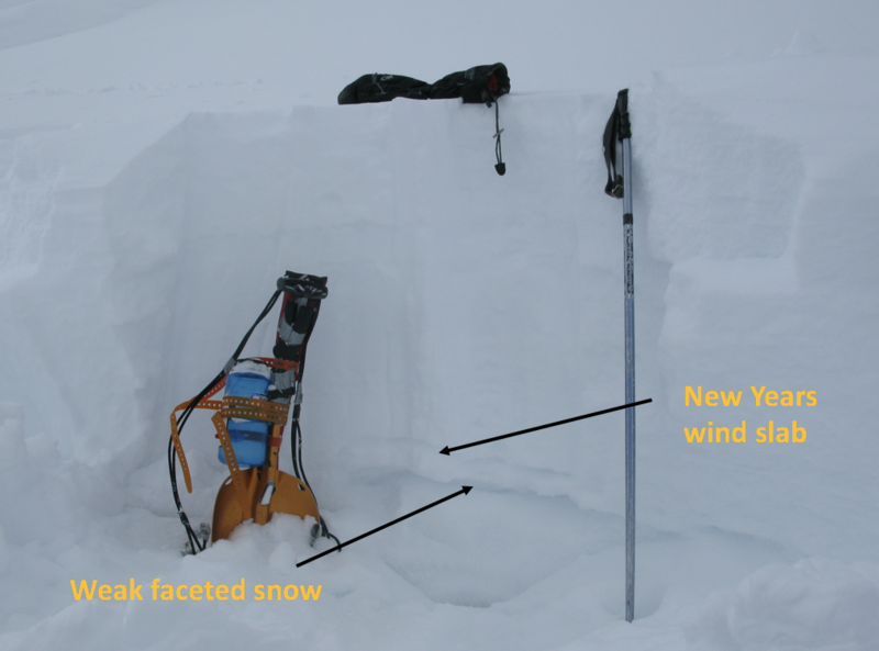
I took a look a large connected pocket that occurred sometime Tuesday as the winds were cranking and snow continued stacking up. A quick crown profile reveals the New Years wind slabs/facet combo is still alive and well, reacting to every significant storm since the turn of the New Year.
Sidenote- no roll of the dice here.... I was able to safely navigate my way down the adjacent slope (lookers left) because it's more gentle in slope angle, has more of a southerly component to it's aspect, and no weak snow near the ground.
Avalanche Problem #2
Wind Drifted Snow
Type
Location
Likelihood
Size
Description
Southerly winds started cranking Friday, continued Saturday and are cranking this morning. There's no shortage of fresh snow to blow around and I suspect todays wind slabs are thicker and more widespread than you might expect. In addition, I think todays drifts are more connected and may break deeper than we might anticipate. While most prevalent on the leeward side of mid and upper elevation ridges, drifting also occurred around terrain features like chutes, gullies, and sub-ridges. In addition, towards days end yesterday, winds cranked even down low near the trailheads so expect to find fresh drifts in unusually low elevation terrain. In any case, today you'll want to look for and avoid any fat, rounded piece of snow, especially if it sounds hollow like a drum.
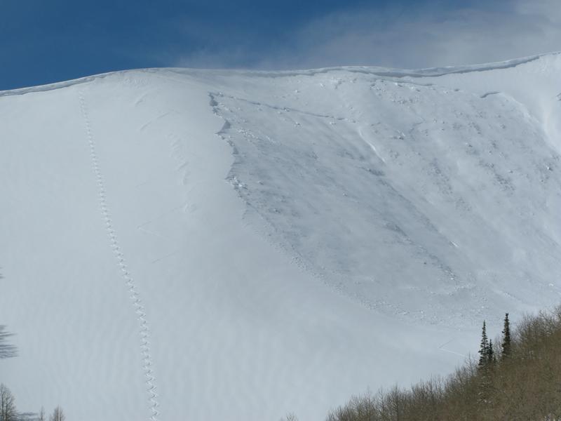
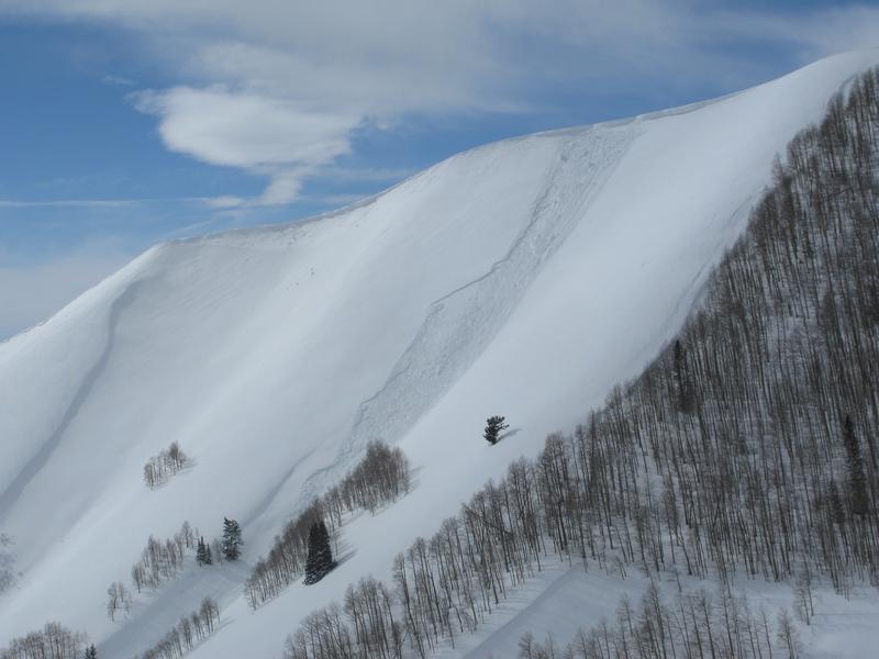
This cornice initiated avalanche, released a deep wind drift once it crashed down on the slope below. Today you'll want to look around for clues to unstable snow and key into Red Flag conditions as the weather changes. And remember- the biggest clue to avalanches... is other avalanches!
Additional Information
A snow shower or two lingers over the region, but should taper off by late morning. Temperatures rise into the mid 20's. Southwest winds continue ramping up throughout the day, blowing in the 50's and 60's, ahead of a potent cold front moving through the region this afternoon. Heavy snow is expected with this front, slamming into the Uinta's right around dinnertime, continuing through about midnight. A foot of snow is a good bet by Monday morning.
General Announcements
The information in this advisory expires 24 hours after the date and time posted, but will be updated by 7:00 AM Monday February 11th, 2019.
If you're getting out and about, please let me know what you're seeing especially if you see or trigger and avalanche. I can be reached at [email protected] or 801-231-2170
It's also a good time to set up one of our very popular avalanche awareness classes. Reach out to me and I'll make it happen.
This information does not apply to developed ski areas or highways where avalanche control is normally done. This advisory is from the U.S.D.A. Forest Service, which is solely responsible for its content. This advisory describes general avalanche conditions and local variations always occur.