Observer Name
Garth
Observation Date
Friday, January 11, 2019
Avalanche Date
Friday, January 11, 2019
Region
SE Idaho » Ant Basin
Location Name or Route
Ant Basin
Elevation
8,400'
Aspect
Northeast
Slope Angle
Unknown
Trigger
Snow Bike
Trigger: additional info
Unintentionally Triggered
Avalanche Type
Hard Slab
Avalanche Problem
Persistent Weak Layer
Weak Layer
Facets
Depth
18"
Width
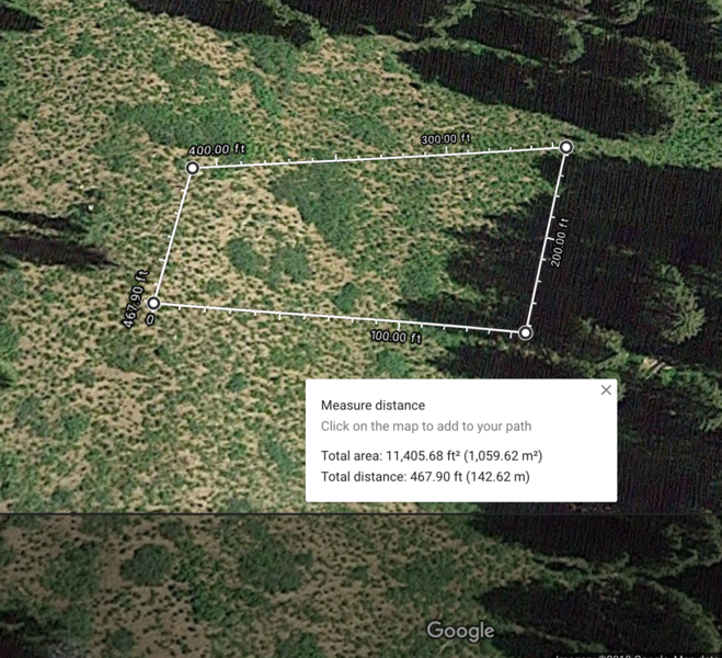
150'
Vertical
200'
Comments
We came into that area from Lago Idaho, up Ant Canyon.
I triggered it with a snowbike. I was trying to ride up through the trees on the north west side but followed others toward the north face (north east). I saw someone stuck in a tree on that north east face so I turned around to help. When I wrapped around a tree my bike washed out from underneath me and tipped over up hill. I stood back up to see the slide happen from the bottom of my snowbike. Fortunately the tree above me kept any snow from sliding above me. The snow depth was probably 16 inches. The width about 150 feet and the length about 200 feet.
Again, nobody was caught in the slide.
A snowmobiler in our group actually triggered another avalanche a little later in the day and he didn't even know it.

Coordinates


