Oh boy, what a treat.
Cold storm left 6-9" (at our elevations) of very low density powder on top of last weeks' storm snow. Fantastic turns but really beneficial that despite the moderate-to-strong prefrontal winds Sunday, the new snow had very little evidence of wind effect at all. The morning provided calm light flurries down low and clearing skies above.
Wind situation changed throughout the day as NE winds started and ramped up to moderate with strong gusts into the late afternoon.
Stability notes were of minimal loose dry sloughing (on steeper aspects with rollovers/rock features and an E-facing component). New storm snow (loose dry) was also reactive to ski cuts on some S-->W aspects with angles over 35 degrees.
This could change if the NE winds persist as we noted the beginnings of surface wind-slab on N aspects as we left late afternoon.
This week's high pressure and warming will also effect the storm snow and test solar aspects.
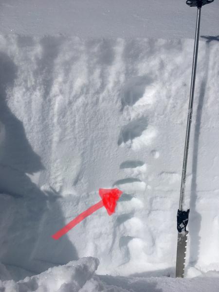
Only new stability discussion point concerned the South-facing compass and possible weakness on a thermal crust that developed with mid-December high pressure and warming. At ~9400' this crust was Pencil-to-Knife hardness and sitting with 60+cm of snow on top. A photo below shows layering but tests showed no weak layering on top of this crust (multiple ECTX's and stubborn SSTs that failed non-planar under the crust) and little ability for the last weeks' right-side-up snow to move on top. As this week warms up this could change with sun effect and percolation.