

Observation Date
12/31/2018
Observer Name
Andrew McLean
Region
Salt Lake » Park City Ridgeline
Location Name or Route
Canyons Periphery
Comments
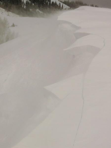
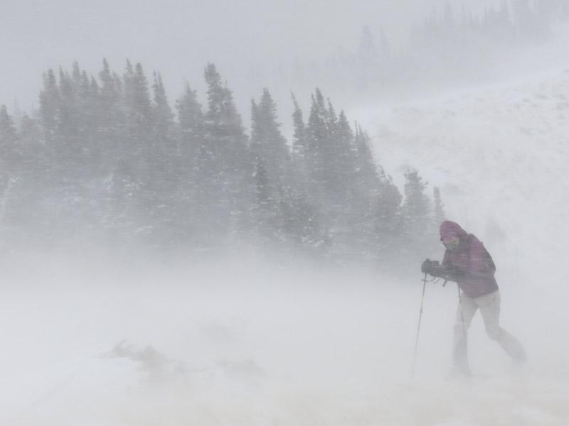
That was an exciting storm with strong winds from the north on Dec 30th, which then mellowed out, followed by a good dose of 7-10" of new light density snow with almost no wind, and then the wind picked up again this afternoon. The lower angle, sheltered skiing was excellent, but the weird weather will create some weird and hard to predict avalanche conditions. I think the most dangerous spots are the steep, wind loaded ridgelines, but even those might be tricky to predict as the wind switched today (at least in the Canyons periphery) and blew from the other direction. This broke down some of the cornices and wind loaded pockets from Sunday, but created some new ones today.
I think in the upper elevation, wind loaded areas it will be very easy to trigger a slide tomorrow and the danger is high. In sheltered, steep, open terrain, the danger is considerable and in the trees or lower and terrain, the skiing is excellent the danger moderate.
Both photos are from Sunday, Dec 30th.
Today's Observed Danger Rating
Considerable
Tomorrows Estimated Danger Rating
High
Coordinates