

Observation Date
12/22/2018
Observer Name
Greg Gagne with Dave Pease
Region
Salt Lake » Big Cottonwood Canyon » Mineral Fork
Location Name or Route
Mineral Fork
Comments
First time in Mineral this year. Mineral has a much thinner snowpack than I've seen in other areas in the central Wasatch, with 45 cms at lower elevations, 45-90 at mid, and about 90 cm at upper elevations around 10,000'. Concern with a thinner snowpack is that the facets both down at the ground as well as mid-pack may not support as much of a load as some areas in the core central Wasatch, where the snowpack depths are 1-1.5 meters. Other thinner snowpack areas in the central Wasatch I'm concerned about include Park City ridgeline, Millcreek, and Lambs Canyon. Video below describes these thinner snowpack areas. Concern is that storm and wind-drifted snow may overload these thinner snowpack areas that have weaker facets in the snowpack.
Video
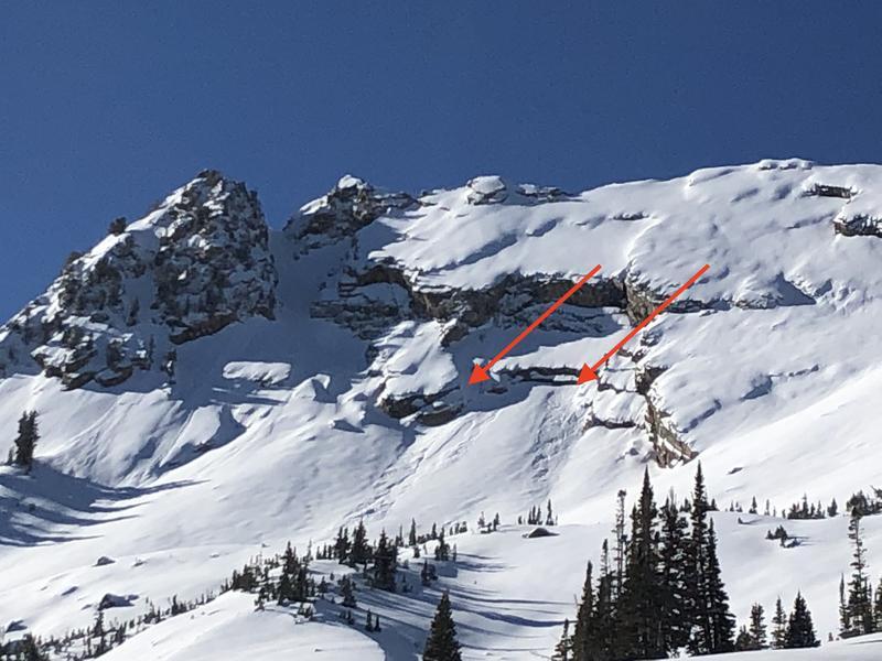
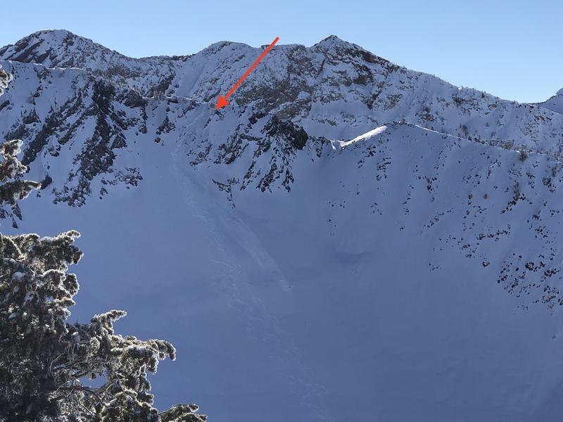
Otherwise, found a few shallow pockets of wind drifts right off ridge lines. Also noted a few naturals just north of Ivory Flakes in Cardiff. Agree with Mark White these likely ran on pooled graupel below cliff bands (first photo). Second photo I took of party entering Room of Doom in Mineral from Mill B South entrance. I later talked to the party and they reported a shall wind slab just off the ridgeline. Am thinking wind drifts will be much less sensitive on Sunday.
Today's Observed Danger Rating
Moderate
Tomorrows Estimated Danger Rating
Moderate