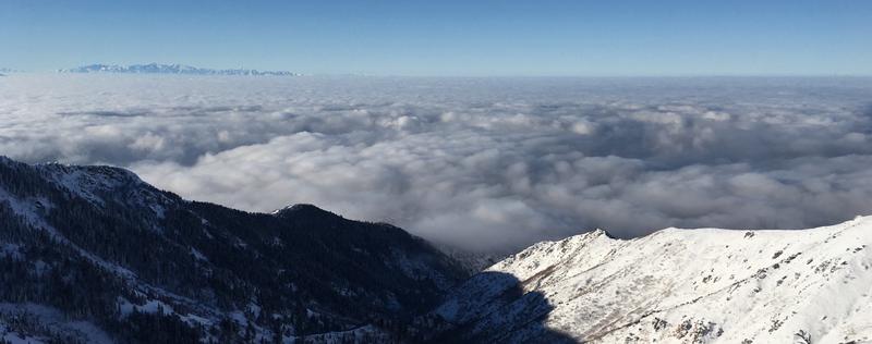
The inversion continues this morning with colder temperatures at low elevations and warmer temperatures at higher elevations (photo above of Ogden Valley by D. Wewer). Temperatures at some trailhead elevations are in the mid teens and low 20's F while at 9000 ft temperatures are in the upper 20's F. Winds this morning above 9000 ft are averaging 15-20 mph gusting 25-35 mph from the S.
Today will have more sunshine and temperatures in the upper 30s F. Winds could increase a little more this afternoon as a weak storm system approaches and the ridge of high pressure moves east. This storm system will not deliver any measurable snow but should help improve valley air quality.
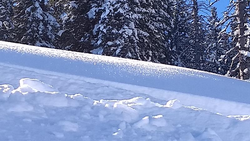
The snow surface has been getting warm and even a little damp on south facing slopes. It remains dry powder on shaded slopes, and some people have been finding a little bit of faceting (weakening) in the surface snow as well as some surface hoar growth (essentially frost on top of the snow). For now this faceting and surface hoar growth improves the riding conditions. In some places on Saturday morning a rime crust formed on the snow surface.
Photo of sparkling surface hoar in the Monte Cristo area (M. Fogg).
No avalanches were reported in the Ogden area mountains.