We have a couple of fun events coming tonight and tomorrow in Salt Lake and Park City.
Tonight - join Greg Gagne and Andrew McLean at Rocksteady Bodyworks in Holladay for an open discussion of Recreating in a New Zone to learn about how the evaluate snow conditions when traveling and skiing in a new zone.
Tomorrow night at the Park City Library, Ascent Magazine presents The Slide Show, a celebration of the coming of winter with video and photo presentations from some of the hardest working trail breakers around.
More info about these events
HERE. In his report from Mt Raymond yesterday, forecaster Greg Gagne wrote, "The sun was ok, but 1 day was enough and I'm ready for another storm." I suppose he'll get his wish, though the current storm moving overhead will leave him (and the rest of us, for that matter) feeling short-changed. We'll be lucky if we squeeze a couple inches out of the southern-track storm. On the other hand, mountain temps are on the order of 15°F warmer than they were at this time yesterday with most stations - at 4am - already in the mid-teens. Southwest winds have bumped overnight and blow 15mph with gusts to 20. Skiing and riding conditions yesterday were - again - nothing short of sublime, but the southerlies will have a breakable sun-crust that'll likely remain intact with today's temps and sky cover. Oh well. Low angle shady slopes will still be divine.
Click the animated weather map below and wave as the storm off the coast of California ejects inland and moves through to the south -
We'll have overcast skies with a few 'traces' of snow with high pressure building back in for the weekend. Temps will be in the 20s with westerly winds 20mph from the west and southwest, diminishing by later this evening.
In their
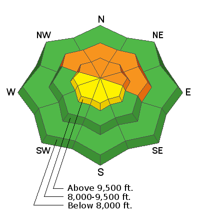
outing into White Pine of LCC yesterday, Mark Staples and Andrew McLean described getting a massive collapse, or whumph, in the snowpack which shook small trees 50' away. Quaking aspens, perhaps. This, of course, is a classic bull's eye sign of an unstable snowpack and a good and easy reminder to remain on low angle slopes. We did not, however, hear of any human triggered avalanches into the old snow yesterday; however, this was not the case for the snow safety teams at the ski areas. Even 'minor' explosive control work produced large avalanches - some stepping through the October crusts to the ground - on upper elevation northwest to northeast facing slopes.
On Mt Raymond yesterday, Greg and his partners triggered a small 6" new snow pocket on its steep south face and reported some minor sluffing in the weakening low density surface snow.


