Observation Date
11/26/2018
Observer Name
Wilson, Torrey, Hardesty
Region
Salt Lake » Park City Ridgeline
Location Name or Route
West Willow, PC Ridgeline
Weather
Weather Comments
Warm, clear, calm.
Snow Characteristics
Snow Characteristics Comments
'Surface hoar braodly distributed throughout tour, from 7800' to 9500'.
Today's damp snow surface on solar aspects will be tomorrow's crust.
Windbuff on exposed ridge lines.
Excellent (if tentative) powder skiing out there. Sporty exit.
Red Flags
Red Flags
Recent Avalanches
Cracking
Collapsing
Poor Snowpack Structure
Red Flags Comments
Remote triggering of avalanches was common in the last 48 hours, but today we failed to remotely trigger slides in several steep north through northeast bowls.
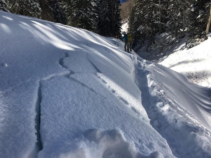
Cracking and collapsing is still the norm: our party heard 10+ good whomphs, with collapses up to 100ft in radius. This indication of poor snowpack structure--and the ability to propagate a fracture--was observed as low as 8600', on aspects ranging from west (260 degrees) to east.
Snow Profile
Aspect
West
Elevation
9,800'
Slope Angle
15°
Comments
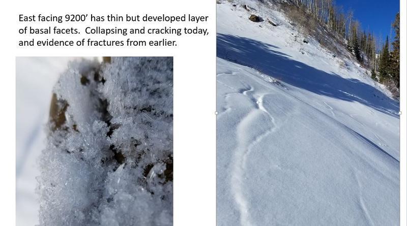
Most avalanches reported to the UAC between Nov 22nd and Nov 26th have been on upper elevation north and northeast aspects. We wanted to see if west aspects were suspect: they are. Extended column tests showed full propagation with 5 light taps on both WNW 8860' and W 9800'. East aspects at 9200' held a thin layer of developed facets that produced cracking and collapsing.
Video
Today's Observed Danger Rating
Considerable
Tomorrows Estimated Danger Rating
Considerable