Observation: Grizzly Gulch

Observation Date
11/22/2018
Observer Name
Greg Gagne with Patrice Duvernay
Region
Salt Lake » Little Cottonwood Canyon » Grizzly Gulch
Location Name or Route
Grizzly Gulch
Weather
Sky
Broken
Precipitation
Light Snowfall
Wind Direction
West
Wind Speed
Moderate
Weather Comments
Periods of light, S-1 snowfall with moderate gusts from the West.
Snow Characteristics
New Snow Depth
6"
New Snow Density
Medium
Snow Surface Conditions
Powder
Snow Characteristics Comments
Denser snow from drifting along ridges. Lots of cracking.
Red Flags
Red Flags
Recent Avalanches
Wind Loading
Cracking
Collapsing
Poor Snowpack Structure
Red Flags Comments
Natural and remotely-triggered avalanches, cracking, collapsing. Although avalanche activity today involved small avalanches, lots of bullseye clues about the instabilities of the persistent weaknesses found on aspects facing west through southeast. Likely had a natural avalanche cycle midday during period of high precipitation intensity.
Avalanche Problem #1
Problem
Persistent Weak Layer
Trend
Increasing Danger
Problem #1 Comments
It did not take much of a load today for the snowpack to become reactive, and with more wind and snow on the way, we can expect more avalanching over the weekend.
Avalanche Problem #2
Problem
Wind Drifted Snow
Trend
Increasing Danger
Comments
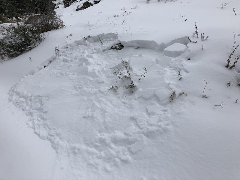
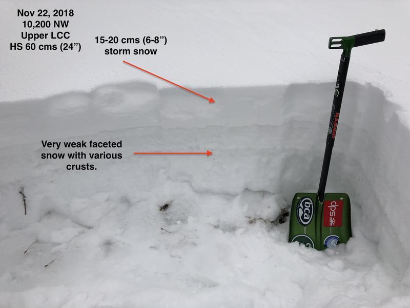
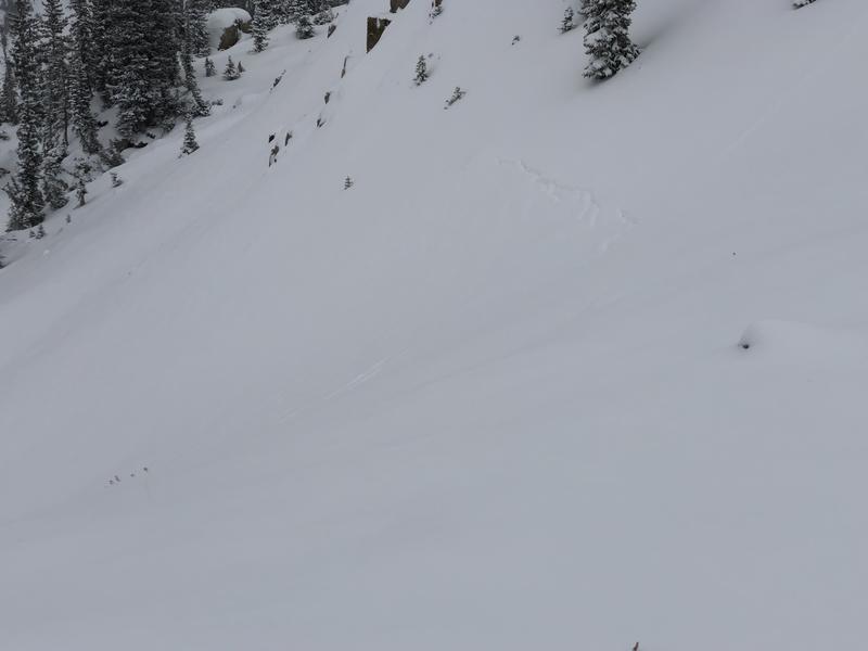
Photos of small natural avalanches, stress cracks, and current snowpack structure showing small (15-20cm / 6-8") Thanksgiving storm snow.
Discussion of current snowpack structure on mid and upper elevation slopes with very weak snow sitting underneath Thanksgiving storm snow. Additional snow and wind over this weekend weekend will further stress these weaknesses.
Video
Today's Observed Danger Rating
Considerable
Tomorrows Estimated Danger Rating
High