Forecast for the Provo Area Mountains

Issued by Drew Hardesty for
Thursday, April 12, 2018
Thursday, April 12, 2018
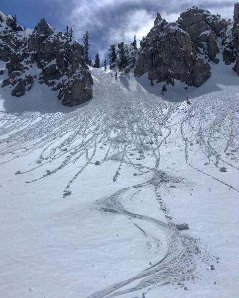
The avalanche danger will rise to MODERATE for new snow instabilities today, particularly with developing wind slabs along the mid and upper elevations. These drifts will be more pronounced on northeast to southeast facing slopes and just to the lee of the ridgelines, and potentially crossloaded beyond the subridges, spines, convexities, and other terrain features. With sustained winds, I expect drifts to become thicker and more widespread over the next 24-36 hours.
As an outlier, deeper wet slabs are unlikely but possible in upper elevation terrain as these elevations continue to transition from winter to spring.
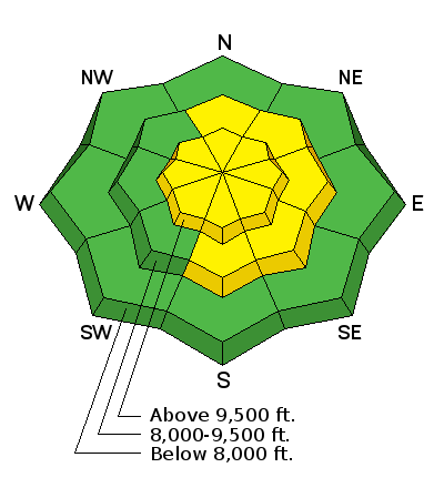
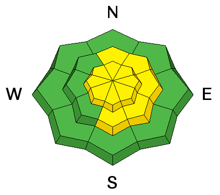
Low
Moderate
Considerable
High
Extreme
Learn how to read the forecast here