Forecast for the Provo Area Mountains

Issued by Evelyn Lees for
Monday, April 9, 2018
Monday, April 9, 2018
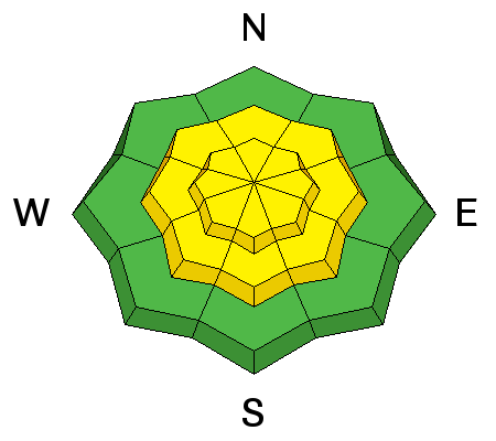
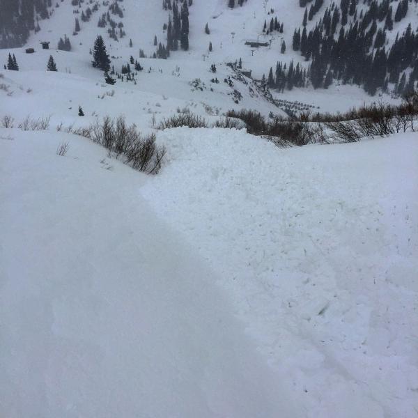
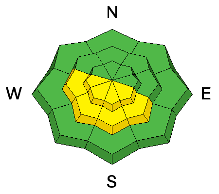
The avalanche danger is MODERATE for triggering very long running, dry loose sluffs on steep and low angle slopes of all aspects and elevations, especially below about 10,000’ and for triggering a slab avalanche at the mid and upper elevations. With sun and warming temperatures, the danger of wet loose sluffs will increase to MODERATE on steep sunny slopes when the snow heats.
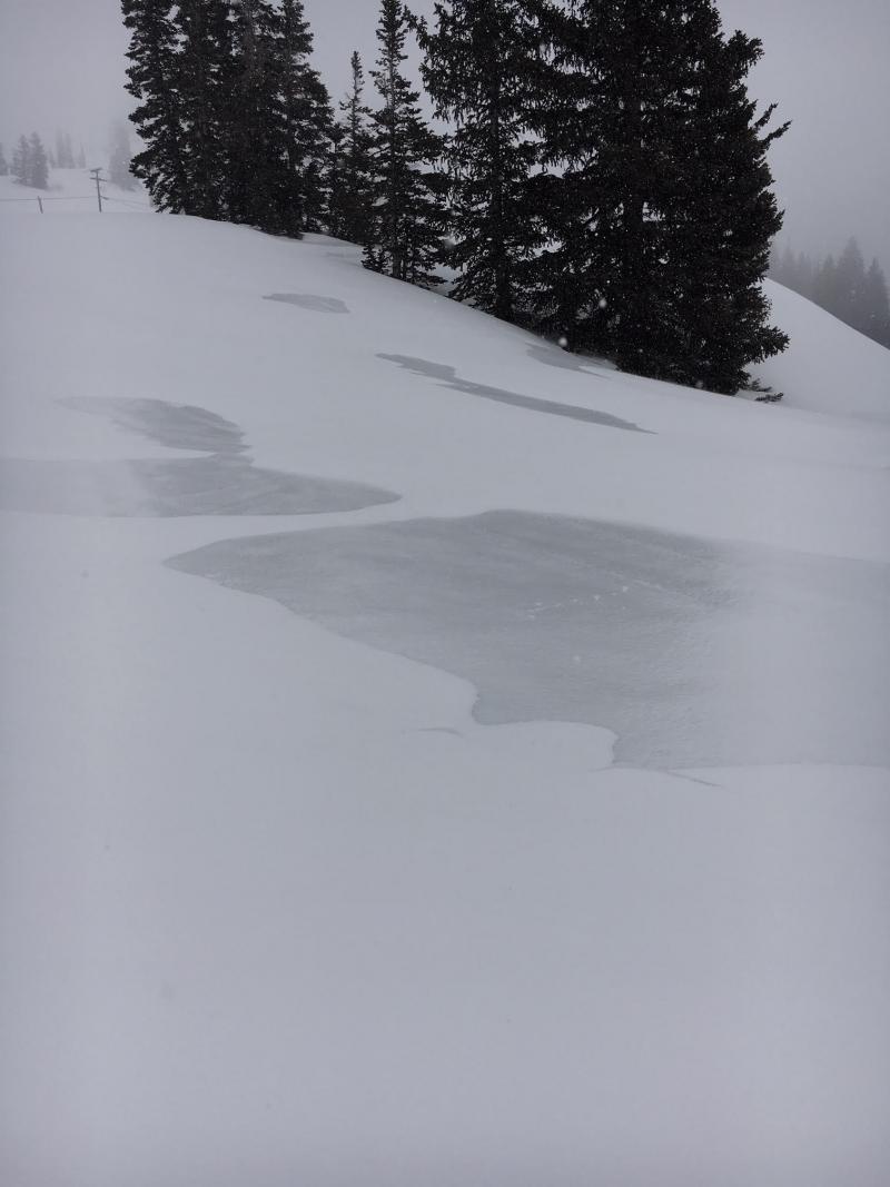
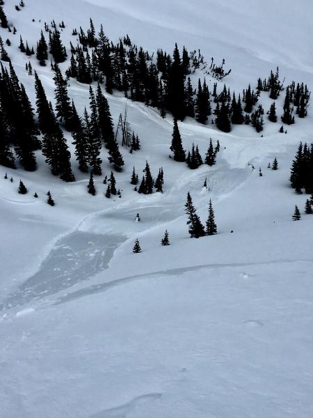
Unusual conditions: with such a slick icy bed surface, even a small sluffs can pick up snow all the way down on to the flats, potentially plowing into a person hundreds of feet below you, and burying them under 6 feet of debris. Be very aware of people above and below you.
Low
Moderate
Considerable
High
Extreme
Learn how to read the forecast here