Grand County will likely be plowing today so expect to find the gate closed between 9:00 and noon.
Episode 7 of the UAC Podcast "Mastery and False Mastery - An Interview with 'Big' Don Sharaf" is live. With a snow career spanning over 30 years, Don has enough mileage in the mountains to have learned a thing or two, including the profound value of humility when staring into the face of the dragon. Listen in on our conversation about the idea of mastery and if such a thing can exist in the avalanche world. Check it out on the UAC blog, ITunes, Stitcher, or wherever you get your podcasts.
The UAC Marketplace is still open. Our online marketplace still has deals on skis, packs, airbag packs, beacons, snowshoes, soft goods and much more.
INSTAGRAM! We now have a UAC-Moab Instagram page. You can find it here....but better yet follow us on your smartphone. Confused? Ask a teenager.
Skies are mostly clear, WNW winds are mostly light, and 10,000' temps are in the single digits. The past two days have been the best of the season with 16" of snow falling during the day on Sunday. But it is March, and the strong sun yesterday dampened the snow surface to the point that most sun exposed slopes will have a stout crust on them this morning. A slight bump in NW winds Sunday evening also affected the snow surface on exposed northerly aspects, so powder seekers will have to move to more sheltered locations. Tim Mathews was out with a crew yesterday and sent in this observation.
Base depth in Gold Basin: 51" Base depth at Geyser Pass Trailhead: 37"
New snow totals in Gold Basin.
Snow totals at the Geyser Pass Trailhead, (9600')
Wind, temperature, and humidity on Pre Laurel Peak (11,700')
Road conditions to Geyser Pass Trailhead: Grand County will likely be plowing today so expect to find the gate closed between 9:00 and noon. If you get there before the plow expect to find deep, rutted snow and very slick conditions.
Grooming conditions: Trails are not groomed and are covered in deep snow.

NW winds have affected the snow surface in the high country. Note crossloading and drifting. (Tim Mathews photo)
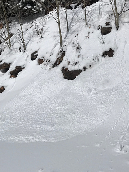
Most of the avalanche activity during the storm was confined to the new snow running as loose snow sloughs, storm slabs or wind slabs, but there appears to have been a few pockets in steep, rocky terrain that pulled out into older snow. Brian Hays reported avalanche activity from Dory Canyon, as well as some collapsing of the snow pack, and Tim Mathews observed avalanche activity from the storm event in Gold Basin. Tim also observed a small wet avalanche yesterday.
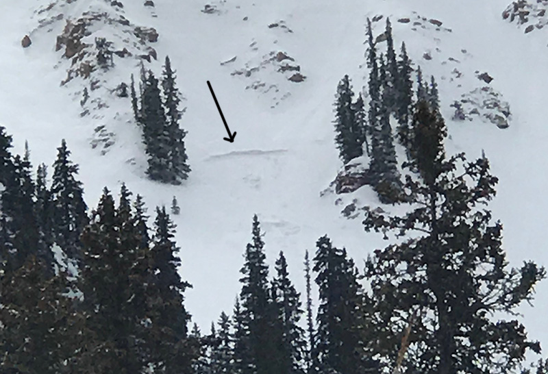
This avalanche appears to have broken into old snow and looks to be up to 3' deep. Note the character of the surrounding terrain - rocky, featured, and right near treeline, a typical area for finding underlying weak snow. (Tim Mathews photo)