

Progression of danger roses for the Salt Lake mountains for 3/9 - 3/15. (Click on the day of the week for the archived forecast for that day.)
Friday Saturday Sunday Monday Tuesday Wednesday Thursday


 Moderate Moderate Moderate Moderate Moderate Considerable Considerable
 Summary - Two significant human-triggered avalanches over the weekend followed by strong warming early in the week. Rain and dense snow late in the week.
Friday March 9 - Quiet day with no reported avalanche activity..
Saturday March 10 - Large avalanche triggered by snowmobiler in First Cornice, an area on the Midway-side of Guardsman Pass. This slide broke down to weak faceted snow near the ground. [Photos Colby Stetson]
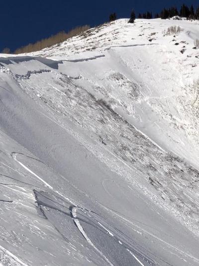
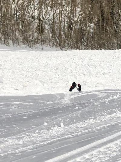
Sunday March 11 - A second, snowmobiler-triggered avalanche in the Guardsman Pass area. This also broke down to weak faceted snow near the ground. It was on a SE aspect at 9500' The slide was 150' wide with 6' crown in places. It ran 500' vertical.

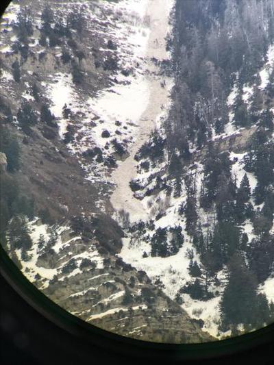
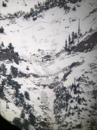
Monday March 12 - Strong warming leads to the usual round of natural wet loose activity, and a skier is hit by anatural wet loose avalanche in Little Pine Chute- a steep, south-facing feature in Little Cottonwood Canyon. The slide occurred around noon. The rider was injured, but fortunately able to ski out on her own. This follows a pattern we have seen far too often this season - too many close calls.
Tuesday March 13 - Continued warming with many mountain reporting stations remaining well above freezing. Wet slab avalanche activity was especially pronounced in the Provo mountains.
Wednesday/Thursday March 14/15- Changing weather with rain to 9000' followed by progressively colder weather and snow dropping to valley floors. No significant avalanche activity reported. 6-12" of snow reported in the Cottonwoods, with ~1.5" of water weight. Half of those amounts on the Park City side of the range.


