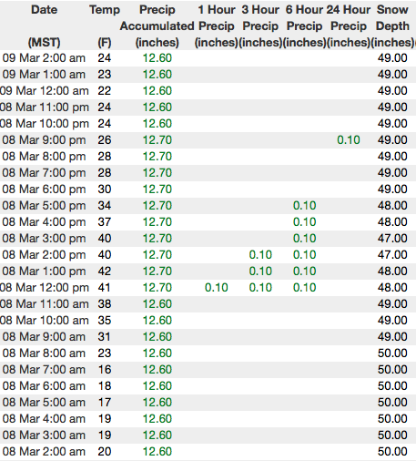
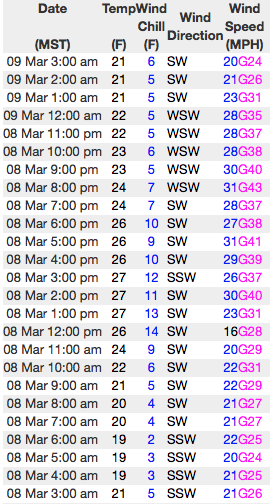
Forecast for the Uintas Area Mountains

Craig Gordon
Issued by Craig Gordon for
Friday, March 9, 2018

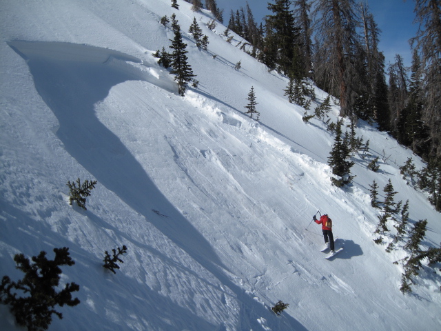
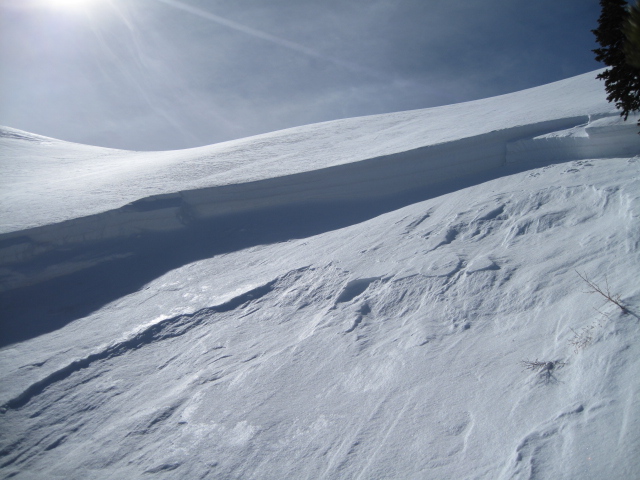
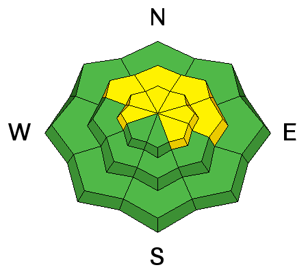
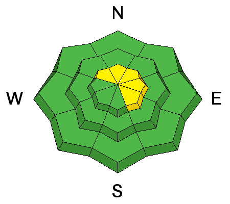
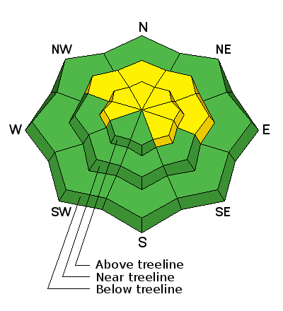
In upper elevation terrain, especially in the wind zone at and above treeline, the avalanche danger is MODERATE. Human triggered avalanches are POSSIBLE on steep wind drifted slopes facing the north half of the compass, particularly those with an easterly component to their aspect. Any avalanche breaking into weak layers of snow, now buried deeper in our snowpack will quickly ruin your day.

LOW avalanche danger exists on mid and lower elevation, wind sheltered terrain and on most slopes facing the south half of the compass.

Low
Moderate
Considerable
High
Extreme
Learn how to read the forecast here
Weather and Snow

Skies are clear and temperatures in the low 20's. Southwest winds were stronger than expected yesterday, blowing in the 30's and 40's, but calmed down somewhat overnight and currently blow in the 20's along the high ridges Sunny slopes have a thin crust, but riding and turning conditions remain quite good, particularly on mid elevation, wind sheltered, shady slopes.

Above are 24 hour temperatures and snow depth from Trial Lake along with winds and temperatures from Windy Peak. More remote Uinta weather stations are found here

You can find a great body of recent trip reports, observations, and snow data here.


Recent Avalanches


We took a look at Wednesdays' avalanche in Humpy Creek which was triggered by the 4th sledder on the slope. While a bit shaken, the rider was able to get off the moving piece of snow and came out on top. Breaking 4' deep and about 75' wide, it broke close to the ground on faceted snow above the Thanksgiving raincrust. More details are found here.

Ad
Avalanche Problem #1
Persistent Weak Layer
Type
Location
Likelihood
Size
Description

Take a look at the picture above. Curious that the steep slopes to the lookers left stayed intact, while the nearby slope to the right avalanched. Investigating the avalanche we found just a little nuance in snowpack structure along with a slight midslope breakover. The 4th rider on the slope was able to knock the legs out from under the slab... yep, these are the characteristics of a persistent slab. Just when you're feeling good about stability.. bam! You're staring down the barral of a scary slide.

Yes, in most terrain across the range the pack is happy in its own skin. However, the Uinta's are a big zone and I bet there's still a surprise or two lurking out there today. Prime suspects include terrain that has already avalanched this year along with a vast majority of steep, shady slopes that have remained thin and shallow this winter. Terrain with these characteristics remains sketchy and should be considered guilty until proven otherwise. Sounds complicated, but the answer is easy. The way we manage unpredictable avalanche dragons is to simply avoid where they live. If you're looking for powder and safe riding, simply tone down your slope angles and avoid terrian with steep, wind drifted slopes hanging above you.

Avalanche Problem #2
Wind Drifted Snow
Type
Location
Likelihood
Size
Description

Not particularly widespread, there might be a rogue drift or two that remains reactive to the additional weight of a rider. Stiff wind slabs are most prevalent on the leeward side of upper elevation ridges and around terrain features like chutes and gullies. Today's hard slabs are gonna be a bit stubborn, but once triggered, can potentially break deeper and wider than you might expect and are gonna pack a punch. You can ride safely today by looking for and avoiding fat, rounded pillows of snow, especially if they sound hollow like a drum.

Additional Information

High pressure continues over the region, giving us mostly sunny skies and temperatures climbing into the low 40's. West and southwest winds blow in the 20's and 30's along the high peaks. Clouds increase late this afternoon and evening as a weak disturbance grazes the area tonight and Saturday. We'll see an inch or snow before high pressure briefly builds for Sunday.

General Announcements

The information in this advisory expires 24 hours after the date and time posted, but will be updated by 7:00 AM Saturday March 10th, 2018.

If you're getting out and about, please let me know what you're seeing especially if you see or trigger and avalanche. I can be reached at [email protected] or 801-231-2170

It's also a good time to set up one of our very popular avalanche awareness classes. Reach out to me and I'll make it happen.

This information does not apply to developed ski areas or highways where avalanche control is normally done. This advisory is from the U.S.D.A. Forest Service, which is solely responsible for its content. This advisory describes general avalanche conditions and local variations always occur.