Observation Date
2/14/2018
Observer Name
Ted Scroggin
Region
Uintas » Millcreek
Location Name or Route
Mill Creek
Weather
Sky
Scattered
Wind Direction
Southwest
Wind Speed
Moderate
Weather Comments
A day of changing weather with the morning skies partly cloudy and light winds, but the afternoon skies were mostly cloudy and the winds were in the moderate range from the southwest and higher gusts on ridge lines.
Snow Characteristics
New Snow Depth
4"
New Snow Density
Medium
Snow Surface Conditions
Powder
Dense Loose
Wind Crust
Snow Characteristics Comments
The last shot of snow a couple days back, put down about 4" of moderate density snow in the Mill Creek area. Riding and turning conditions are quite nice in sheltered areas out of the wind zone, but the winds were getting gusty and blowing lots of snow around today.
Red Flags
Red Flags
Wind Loading
Cracking
Poor Snowpack Structure
Red Flags Comments
Winds were quickly changing the landscape today, creating lots of blowing and drifting snow even into lower terrain. Cracking of fresh wind drifts and shallow wind slabs were developing this afternoon. A day of rising hazard. The Mill Creek area has some thin and weak snow, but the snow stability was generally good today, however winds and an approaching storm will change the hazard.
Avalanche Problem #1
Problem
Wind Drifted Snow
Trend
Increasing Danger
Problem #1 Comments
Increasing winds were drifting and forming fresh drifts and shallow wind slabs along the ridge lines.
Avalanche Problem #2
Problem
Persistent Weak Layer
Trend
Increasing Danger
Problem #2 Comments
No change in the stability this morning of the buried sugary faceted snow, but the increasing winds and storm moving in may be enough to increase the chance of triggering an avalanche?
Comments
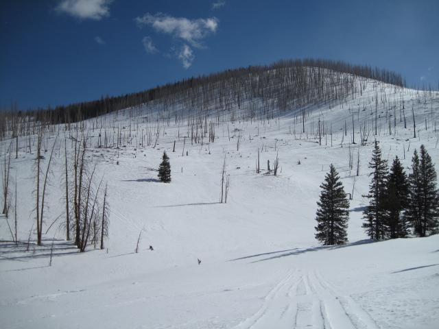
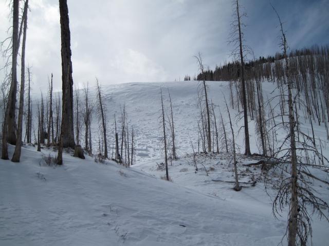
Generally still thin snow cover in the upper Mill Creek drainage.
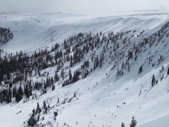
Spotted this natural avalanche while looking into Cataract Basin. A few days old and not too surprised to see some natural activity in this heavy wind loaded area.
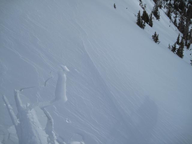
Fresh wind drifts and shallow slabs were developing today on the high ridge lines with gusty southwest winds.
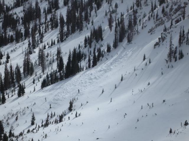
This slide that happened over a week ago is starting to fill in and could be a potential repeater avalanche with weak snow under the freshly drifting snow.
Today's Observed Danger Rating
Moderate
Tomorrows Estimated Danger Rating
Moderate