Sign Up for the Utah Snow and Avalanche Workshop (USAW) on December 7th!

Observation: Reynolds Pk

Observation Date
2/12/2018
Observer Name
Staples and Lees
Region
Salt Lake » Big Cottonwood Canyon » Reynolds Pk
Location Name or Route
Reynolds Peak
Weather
Sky
Obscured
Precipitation
Light Snowfall
Wind Speed
Calm
Weather Comments
Cloudy with periods of decent snow but not accumulating too much. Periods of sun. Increased S winds on Sunday (Feb 11) did not transport any noticable snow.
Snow Characteristics
Snow Surface Conditions
Powder
Snow Characteristics Comments

3-4 inches of new snow. Some from Saturday and some from this morning. That snow greatly improved skiing and riding conditions. On steeper slopes, you could still feel some crusts underfoot. Lower angle slopes with no old tracks had great riding condtions.

Comments

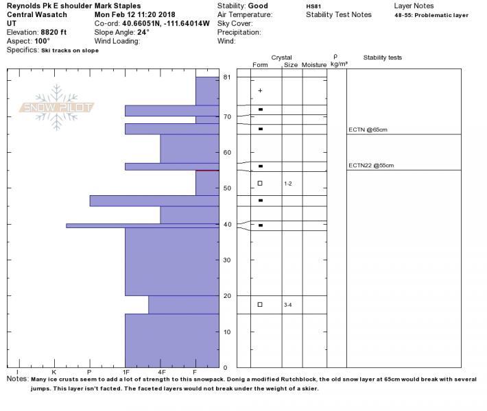
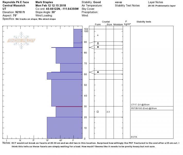
Sunday's S winds did not transport snow or form wind slabs on Reynolds Pk. We still found dry facets in the snowpack. Overall the snowpack has widely varying strength. Reynolds E face had avalanched earlier this year and only has about 2 1/2 feet of snow. There is an obvious layer of facets about 3-6 inches above the ground.

There has been no recent (reported) avalanche activity, minimal new snow, no wind transport and all ECT results continue to be ECTN or ECTX (meaning it doesn't propagate or doesn't break at all). For these reasons the danger is low.

Buried facets seem like they will need a decent load to become active again. Probably greater than an inch of SWE in a short period. Hard to say exactly but the next storm of just a few inches of snow won't be enough to make them unstable.

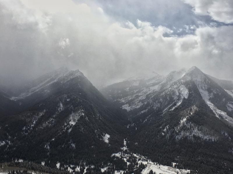
Photo below looking at Kessler Peak (right) and into Cardiff fork from the top of Reynolds Peak.
Today's Observed Danger Rating
Low
Tomorrows Estimated Danger Rating
Low