

Forecast for the Uintas Area Mountains

Tuesday morning, February 13, 2018
While the avalanche hazard is generally LOW be on the lookout for shallow drifts along the leeward side of upper elevation ridges. In addition, avalanches breaking to our midpack facet/crust combo remain possible in isolated terrain. The usual suspect terrain comes to mind... steep, leeward slopes facing the north half of the compass, especially those in the wind zone.
 Special Announcements
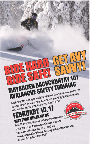
We still have a few open slots for this weeks Avy Moto 101. Click here for more details and to register.
 Weather and Snow
Yesterday's storm delivered 2"-4" of ultra-light density snow across the range. Clouds dissipated late yesterday and skies cleared overnight. Temperatures are in the teens and winds are light and variable, blowing less than 10 mph even along the highest peaks. Riding and turning conditions are surprisingly good, particularly on mid elevation, wind sheltered slopes.
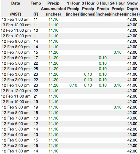
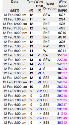
Above are 24 hour temperatures and snow depth from Trial Lake along with winds and temperatures from Windy Peak. More remote Uinta weather stations are found here
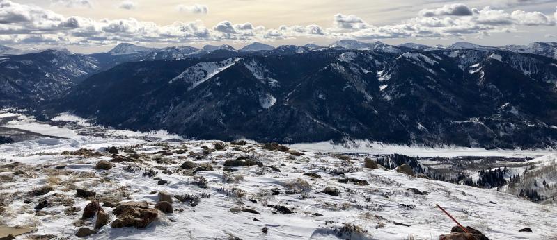
Stomping along a wind scoured ridge, Andy grabbed this scenic image of the north facing terrain in upper Weber Canyon. (Nassetta photo)
A great body of recent trip reports, observations, and snow data are found here.
 Recent Avalanches
Shallow wind slabs and sluffing on steep slopes were reported yesterday, otherwise no significant new avalanche activity.

Wind Drifted Snow
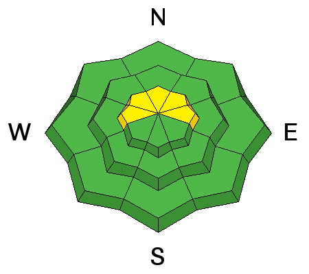
Description
Monday's winds were able to whip recent light density storm snow into fresh drifts, sensitive to our additional weight. Found on the leeward side of upper elevation ridges and around terrain features like chutes and gullies, recently formed drifts will predictably break at or below our skis, board, or sled. While mostly manageable in size and depth take care that a small slide doesn't blindside you in steep, high consequence, commiting terrain.
Persistent Weak Layer
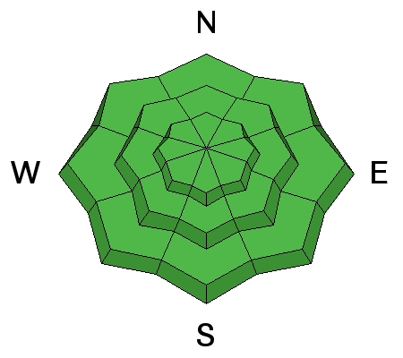
Description
As the snowpack gets comfortable in its own skin, the possibilty of triggering an avalanche that breaks to our persistent midpack weakness, the Thanksgiving crust/facet combo, begins to decrease... and that's good news, suggesting we're trending in the right direction. I wouldn't exactly call it a "green light, ride if it's white" kind of snowpack, but I do think you'd really have to go out of your way to trigger a significant avalanche today. The most likely type of terrain is steep, upper elevation slopes, especially those facing the north half of the compass. While more the execption than the rule, once triggered, an avalanche breaking near our midpack problem child will quickly get out of hand and could instantly ruin our day. Fortunately, the riding conditions are improving on other aspects and we have more options on the table to avoid this avalanche dragon. Simply swing around to lower elevation slopes or choose low angle terrain with no steep slopes above or adjacent to where you're riding.
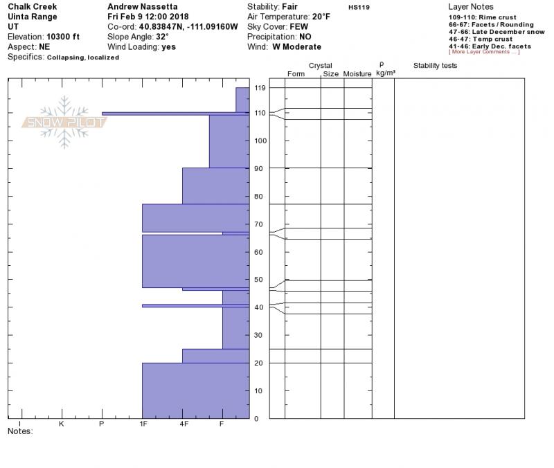
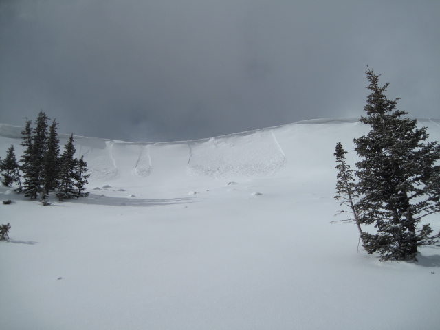
The snowpit above reveals the unusual structure of our current snowpack. Dormant for now, but could come alive with additional significant water and wind.
Additional Information
Look for clearing skies with temperatures rising into the 30's. Winds will be light and variable. Overnight lows dip into the teens. Increasing clouds are slated for Wednesday with another small storm sliding though the region for Thursday/Friday.
General Announcements
The information in this advisory expires 24 hours after the date and time posted, but will be updated by 7:00 AM Wednesday February 14th, 2018.
If you're getting out and about, please let me know what you're seeing especially if you see or trigger and avalanche. I can be reached at [email protected] or 801-231-2170
It's also a good time to set up one of our very popular avalanche awareness classes. Reach out to me and I'll make it happen.
This information does not apply to developed ski areas or highways where avalanche control is normally done. This advisory is from the U.S.D.A. Forest Service, which is solely responsible for its content. This advisory describes general avalanche conditions and local variations always occur.