Observation: Twin Lakes area

Observation Date
1/31/2018
Observer Name
chester
Region
Salt Lake » Big Cottonwood Canyon » Twin Lakes area
Location Name or Route
Twin lakes
Weather
Sky
Overcast
Wind Direction
Southwest
Wind Speed
Moderate
Weather Comments
Cooler. Windy. High clouds.
Snow Characteristics
Snow Surface Conditions
Powder
Faceted Loose
Wind Crust
Melt-Freeze Crust
Rain-Rime Crust
Snow Characteristics Comments
Snow stayed dry today up high.. Rime is thinner than yesterday.. Melt freeze crust farly widespread out of shade. Lots of tracks in twin lakes.
Red Flags
Red Flags
Wind Loading
Cracking
Poor Snowpack Structure
Red Flags Comments
Only little cracking on small Cornice observed.
Avalanche Problem #1
Problem
Persistent Weak Layer
Trend
Decreasing Danger
Problem #1 Comments
Nothing to add other than with snow transported, some places may see a little extra loading today
Avalanche Problem #2
Problem
Wind Drifted Snow
Trend
Decreasing Danger
Problem #2 Comments
Snow was moving a bit on ridges and midslope in twin lakes area. Small new cornices observed on ridge. No signifigant/obvious wind slabs observed in area toured, but wouldn't be suprised if different elsewhere.. Seemed like more snow avail for transport today than yesterday.
Comments
Rime is thinning, riding much improved in some areas although much more m/f crust to deal with from yesterdays heating. Rime crust is very thin now. Guessing will dissappear before next storm. Rime bonding is patchy, maby facets below. 
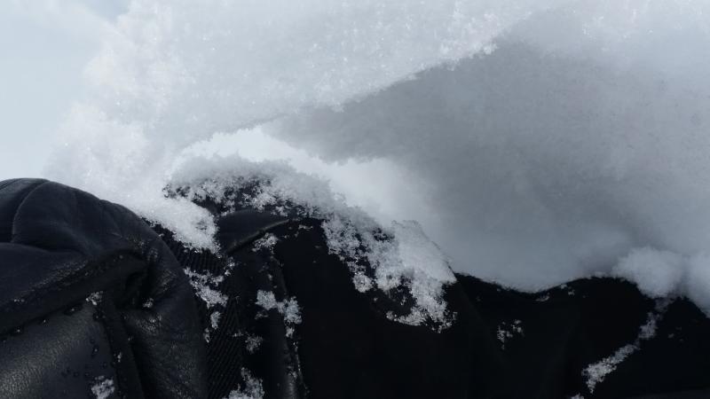
Pic 1. Very small Cornice on ridge w small cracking. 
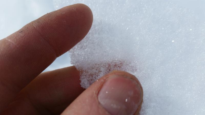
Pic 2. Thin rime, much thinner than mon. sublimation away? Faceting from below? 
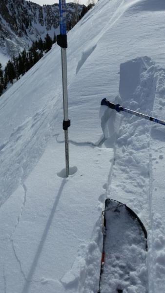
Pic 3 wierdo shovel tilt test, clean shear below very thin rime layer failing on facets below rime.
Today's Observed Danger Rating
Moderate
Tomorrows Estimated Danger Rating
Moderate