Observation: Upper Weber Canyon

Observation Date
1/28/2018
Observer Name
jg
Region
Uintas » Upper Weber Canyon
Location Name or Route
Upper Weber Canyon
Weather
Sky
Scattered
Wind Direction
Northwest
Wind Speed
Light
Weather Comments
Clouds breaking up by mid day and low cloud ceiling on and off through early afternoon. Noticed the low cloud ceiling yesterday late in the day.
Snow Characteristics
Snow Surface Conditions
Powder
Dense Loose
Wind Crust
Rain-Rime Crust
Damp
Snow Characteristics Comments

Rime event last night left a thin, zipper crust on many slopes facing the north half of the compass. Wind skins and slabs prevalent as well. Snow damp on solar aspects and at lower elevations.

Red Flags
Red Flags
Recent Avalanches
Cracking
Poor Snowpack Structure
Red Flags Comments
No wind loading today but plenty of old wind slabs from the past several days. Cracking confined to the old wind slabs. Plenty of signs of old avalanches in our travels, mostly a couple of days old or older but some within the last 24 hours. The poor snow structure is nothing new and something we'll have to deal with for weeks to come.
Avalanche Problem #1
Problem
Wind Drifted Snow
Trend
Decreasing Danger
Problem #1 Comments

Prevelant in the wind zone but fairly easy to identify, these should start settling out, so decreasing danger in the next couple of days.

Avalanche Problem #2
Problem
Persistent Weak Layer
Trend
Same
Problem #2 Comments

Still worrisome. There are multiple persistent week layers in the pack now. Stability tests are variable, sometimes getting full propagation on ECT's and sometimes not. Spacial variability is another factor as you try to accumulate data.

Snow Profile
Aspect
North
Elevation
10,600'
Slope Angle
30°
Comments

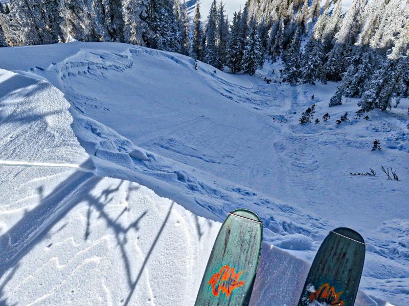
Intentional cornice drop on a north facing, 38° slope released a persistant slab avalanche ≈ 60 ft. wide, 8"-24" deep and ran ≈ 300 ft. Failed on a faceted crust which was probably the old snow surface before the storm on 1/20. Debris piled up 4-6 ft. in the trees. Would not have been a pleasant ride through the trees.

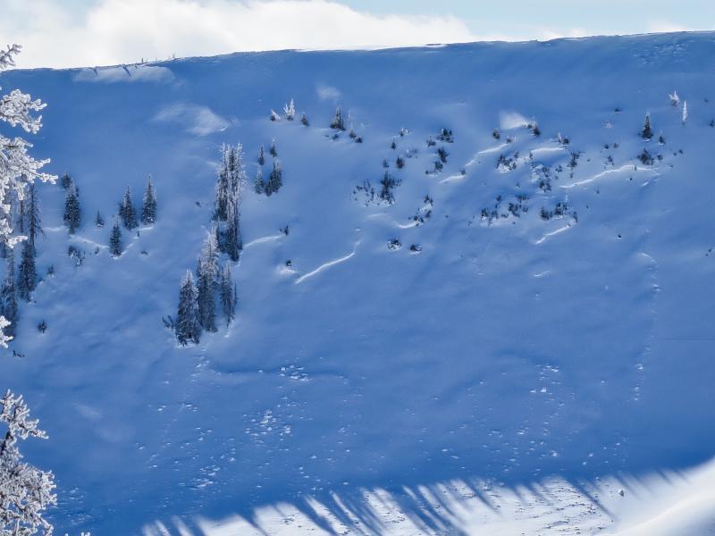
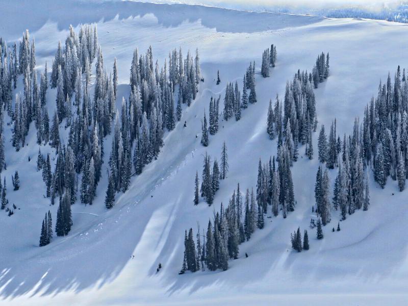
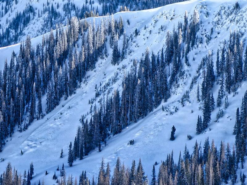
Avalanches from this last week. These are on steep north facing slopes.

The persistant slab issue continues to be the topic of most concern and is very unpredictable in my opinion. Terrain choices and slope angles are of utmost importance with high consequence probability if you trigger a slide. I'm generally seeing signs of healing with some rounding of the faceted grains and good bridging in places but each new storm is likely to reactivate these persistant weaknesses. We'll have to see what this week brings with warming temps and no real snow forecasted until the weekend. If you're traveling in the wind zone and in steeper terrain on the north half of the compass I would consider the danger considerable. Moderate elsewhewre.

Today's Observed Danger Rating
Moderate
Tomorrows Estimated Danger Rating
Moderate