Forecast for the Uintas Area Mountains

Wednesday morning, January 24, 2018
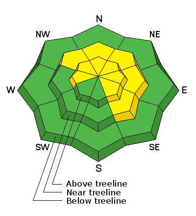
In the wind zone at and above treeline the avalanche danger is MODERATE. Human triggered avalanches are possible on steep, wind drifted slopes, especially those facing the north half of the compass and particularly those with an easterly component to their aspect . Once triggered, today's avalanches can quickly get out of hand if they break into weak layers of snow now buried several feet deep in our snowpack.
Most mid and low elevation terrain, especially south facing slopes offer generally LOW avalanche danger.
 Weather and Snow
Skies are clear and temperatures slightly inverted... in the mid to upper teens. Along the high ridges, southwest winds starting bumping into the mid and upper 20's right around midnight. The riding and turning conditions are the best they've been all year.

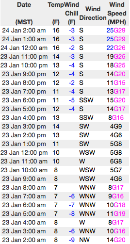
Above are 24 hour temperatures and snow depth from Trial Lake along with winds and temperatures from Windy Peak. More remote Uinta weather stations are found here
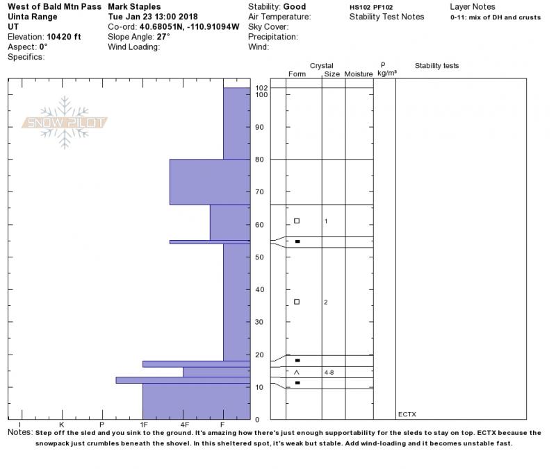
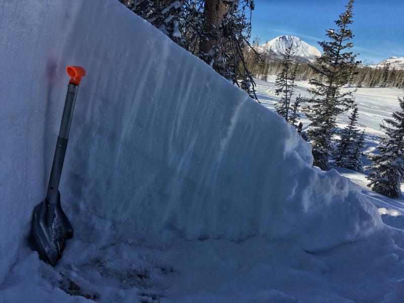
Mark was near Bald Mountain yesterday and found very weak snow, but no slab. More on his travels are found here.
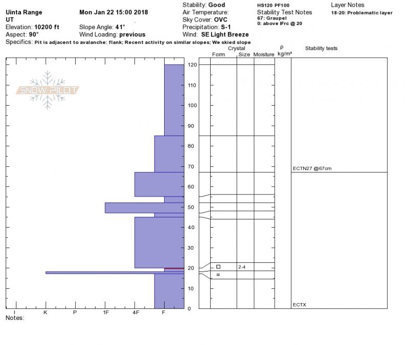
Meanwhile, back at the ranch, downtown Chris Brown was stomping around Weber Canyon and posted his snowpit findings. In either case, there's a great body of recent travels and insights, along with a string of trip reports can be seen here.
 Recent Avalanches
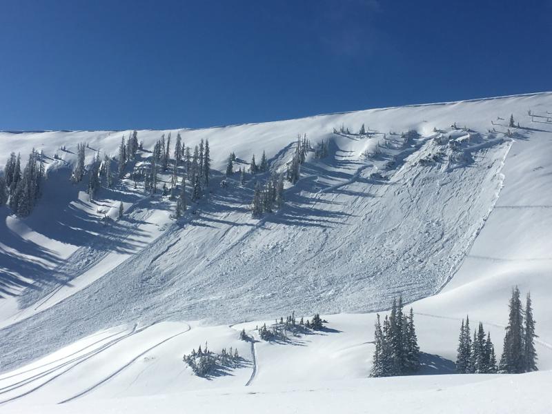
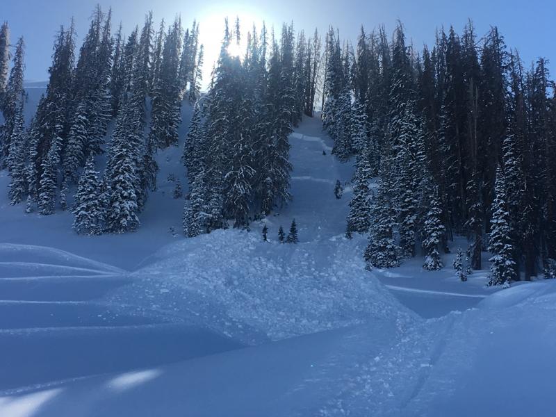
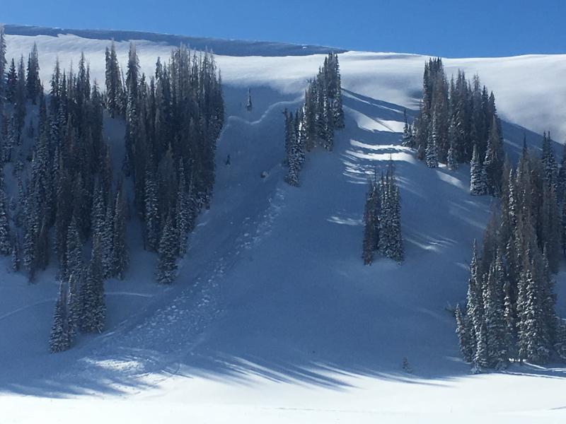
I rolled up to this fresh avalanche in Upper Moffit Basin yesterday, just as the dust was settling. I talked with the rider who said he triggered the slide low on the slope on generally flat terrain. Yep.... this is what we call a persistent slab. And nope... you don't have to be climbing to kick the legs out from underneath it. Click here to see how this slab is reacting to our additional weight.
Persistent Weak Layer

Description
The recent string of human triggered slides breaking to weak snow near and around the Thanksgiving raincrust is proof positive the snowpack is not happy in its own skin. The snowpack is still developing and right now it's sort of in its teenage years and flies off the handle pretty easily. Tricky at best... the snowpack is gaining strength and feels strong under our skis, board, or sled. Scary at worst... the snowpack allows us to get well out onto the slope before it fails. And like my teenage years... look at it the wrong way and you're staring down the barrel of an unpredictable slide.
Once triggered, an avalanche breaking into weak layers of snow now buried in our midpack, will quickly get out of hand and instantly ruin our day. The most likely suspects are steep, wind drifted slopes facing north half of the compass. Since this avalanche dragon is unpredictable, the best offense is a good defense... you simply avoid it. Swing around to lower elevation south facing slopes or choose low angle terrain with no steep slopes above or adjacent to the slopes your riding.
This is a spooky setup because it's unpredictable. Slides are not only breaking in big, open bowls, but also in the trees which we normally think of as "safe zones".
Wind Drifted Snow
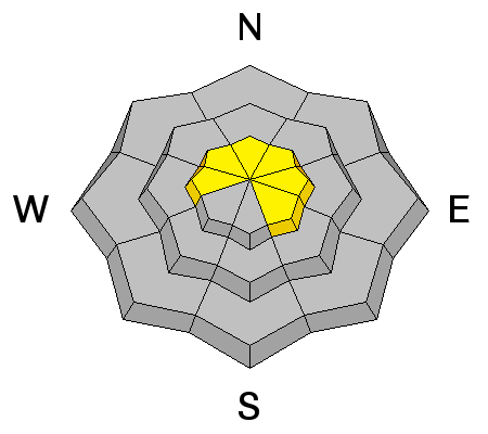
Description
Winds are expected to increase throughout the day and they've got plenty of light density snow to work with. As winds ramp up this afternoon, look for and avoid fresh drifts forming along the leeward side of upper elevation ridges and around terrain features like chutes and gullies.
Additional Information
Short-lived high pressure over the region provides sunny skies with temperatures warming into the 30's. By late in the day southwest winds crank into the 40's and 50's as a fast moving storm sets its sights on the region. Clouds increase for Thursday and snow develops late in the day, continuing through early Friday. Not a big storm, but we should be able to squeak 4"-8" of fresh snow out of this system by midday Friday.
General Announcements
The information in this advisory expires 24 hours after the date and time posted, but will be updated by 7:00 AM Thursday January 25, 2018.
If you're getting out and about, please let me know what you're seeing especially if you see or trigger and avalanche. I can be reached at [email protected] or 801-231-2170
It's also a good time to set up one of our very popular avalanche awareness classes. Reach out to me and I'll make it happen.
This information does not apply to developed ski areas or highways where avalanche control is normally done. This advisory is from the U.S.D.A. Forest Service, which is solely responsible for its content. This advisory describes general avalanche conditions and local variations always occur.


