Planned Website Outage: The UAC website will be down for maintenance on June 17 from 2:00 - 7:00 PM MT.

Observation: Weber Canyon

Observation Date
1/21/2018
Observer Name
Reed Sullivan
Region
Uintas » Upper Weber Canyon » Weber Canyon
Location Name or Route
Western Uintas: Weber Canyon
Weather
Sky
Obscured
Precipitation
Light Snowfall
Wind Direction
North
Wind Speed
Moderate
Weather Comments
Obscured skys in the morning switching to broken/valley fog in the afternoon with some sun poking through. Sminus1 snow through most of the day, with no real accumulation. Winds were light gusting moderate from the north. There was moderate snow blowing as a result in exposed terrain (see picture).
Snow Characteristics
New Snow Depth
11"
New Snow Density
Low
Snow Surface Conditions
Powder
Wind Crust
Snow Characteristics Comments
Ski quality was excellent out of wind affected terrain.
Red Flags
Red Flags
Heavy Snowfall
Wind Loading
Poor Snowpack Structure
Red Flags Comments
Wind slab (1F) observed at 9500ft on an east facing aspect. Multiple hand shear tests revealed crusts or NSF under the new snow on N through E facing slopes we were on between 9000ft and 9500ft. The new snow has not consolidated yet.
Avalanche Problem #1
Problem
Wind Drifted Snow
Trend
Same
Problem #1 Comments
Our group found a wind slab today (1F hardness) that we avoided. We also observed scouring and evidence of wind deposits throughout the day. With the forecasted winds for tonight and tomorrow and the amount of snow still available for transport, I would expect wind to continue to transport snow to keep wind slab as our number 1 issue.
Avalanche Problem #2
Problem
Persistent Weak Layer
Trend
Same
Problem #2 Comments
There are still weak layers of concern within the snowpack. There are still facets on the ground where our group traveled. No formal tests performed today.
Comments
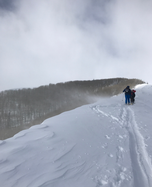
Wind transport on ridgeline blowing SW, 9475ft
Today's Observed Danger Rating
Moderate
Tomorrows Estimated Danger Rating
Moderate