Forecast for the Moab Area Mountains

Eric Trenbeath
Issued by Eric Trenbeath on
Saturday morning, January 20, 2018

The avalanche danger is MODERATE and heightened avalanche conditions exist on steep, northerly facing aspects that have more than about a foot of snow. A persistent slab problem exists in these areas where snow from the last storm cycle is overlying weak, sugary faceted snow on the ground. Even a shallow avalanche could prove injurious due to exposed rocks and trees.

Expect the danger to rise beginning in the late afternoon and evening as an approaching storm system starts producing snow over our area.

Low
Moderate
Considerable
High
Extreme
Learn how to read the forecast here
Special Announcements

We have begun issuing regular avalanche advisories. Field observations taken since the last storm cycle have revealed that there is enough snow cover to create an avalanche hazard in some areas. Snow cover remains very thin, and backcountry travelers are advised to exercise caution due to an abundance of barely covered obstacles.

We've scheduled our annual Backcountry 101 avalanche course for Feb 2,3. For more information or to register go here.

We've also scheduled a Motorized Backcountry 101 for snowmobiles and snowbikes. For more information or to register go here.

Weather and Snow

Skies are cloudy, southerly ridge top winds are averaging 20-25 mph with gusts to 40, and it's 33 degrees at the Geyser Pass Trailhead.

Overall coverage ranges from 8" at the Geyser Pass Trailhead to up to 20" in drifted areas right around treeline and above. In between, sun exposed slopes that had no snow on the ground prior to the last storm cycle have 6" or less, and many wind exposed, upper elevation slopes show bare rocks. Actual turning on skis or snowboards is not recommended, and snowmobiling off of the roads is asking for a damaged machine.

Prior to the December 21 storm most of the terrain was still dry ground. The exception was sheltered, north facing slopes below treeline, and some scattered, protected areas in the alpine where snow had collected in gullies or depressions.

Snowfall History: Dec. 21- 10" Jan. 7 - 4" Jan. 9 - 2" Jan. 10 - 2" Jan. 11 - 4"

New snow totals in Gold Basin.

Snow totals at the Geyser Pass Trailhead, (9600')

Wind, temperature, and humidity on Pre Laurel Peak (11,700')


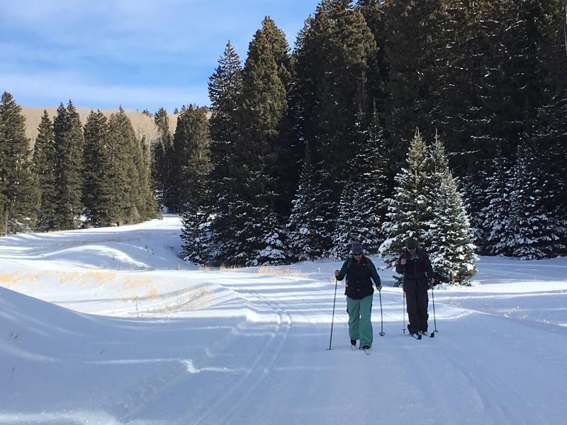
Matt put down a fresh coat of corduroy on Thursday, and recreating on groomed trails is probably the best game in town right now.

Ad
Avalanche Problem #1
Persistent Weak Layer
Type
Location
Likelihood
Size
Description

The current snowpack structure is very weak. Loose, sugary, faceted snow on the ground is providing an unstable base. Though an isolated problem at this time, it is possible to trigger an avalanche on steep, northerly facing aspects above about 10,500' where there is more than about a foot of snow. In some areas it is possible to trigger an avalanche up to 20" deep. Expect this danger to increase overnight as addtional snow load is added to the fragile snowpack.

Additional Information

An approaching storm system will begin producing snow over our area later this afternoon and continue into Sunday. It looks like we may see about 6" High temperatures at 10,000' will be near 30 degrees, and southerly ridge top winds will average 20-25 mph with gusts to 40.

General Announcements

Support the UAC through your daily shopping. When you shop at Smith's, or online at REI, Backcountry.com, Patagonia, NRS, Amazon, eBay a portion of your purchase will be donated to the FUAC. See our Donate Page for more details on how you can support the UAC when you shop.

Benefit the Utah Avalanche Center when you buy or sell on eBay - set the Utah Avalanche Center as a favorite non-profit in your eBay account here and click on eBay gives when you buy or sell. You can choose to have your seller fees donated to the UAC, which doesn't cost you a penny

This information does not apply to developed ski areas or highways where avalanche control is normally done. This advisory is from the U.S.D.A. Forest Service, which is solely responsible for its content. This advisory describes general avalanche conditions and local variations always occur.