We rode in Franklin Basin today and were surprised not to find widespread avalanche activity (although visibility was limited at upper elevations). There was between 12 inches of new snow at 8200 feet and over 18 inches of new snow at higher elevations. The snow was pretty dense and we only sunk in 4-6 inches when making turns. The wind had moved a lot of new snow around and even downed a few trees during yesterday’s storm. We dug several pits and performed a bunch of avalanche tests:
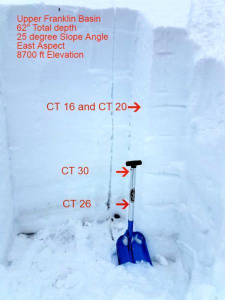
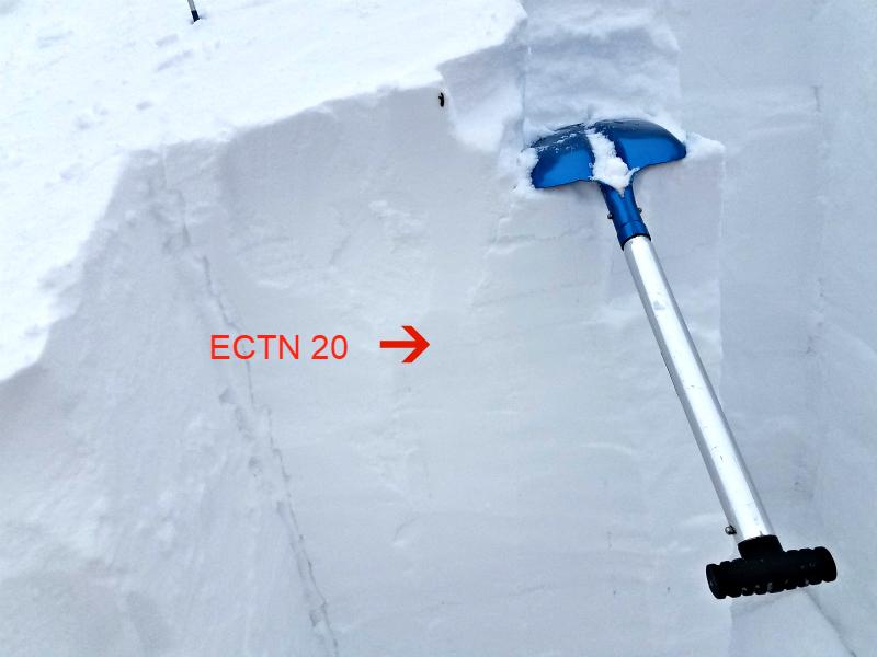
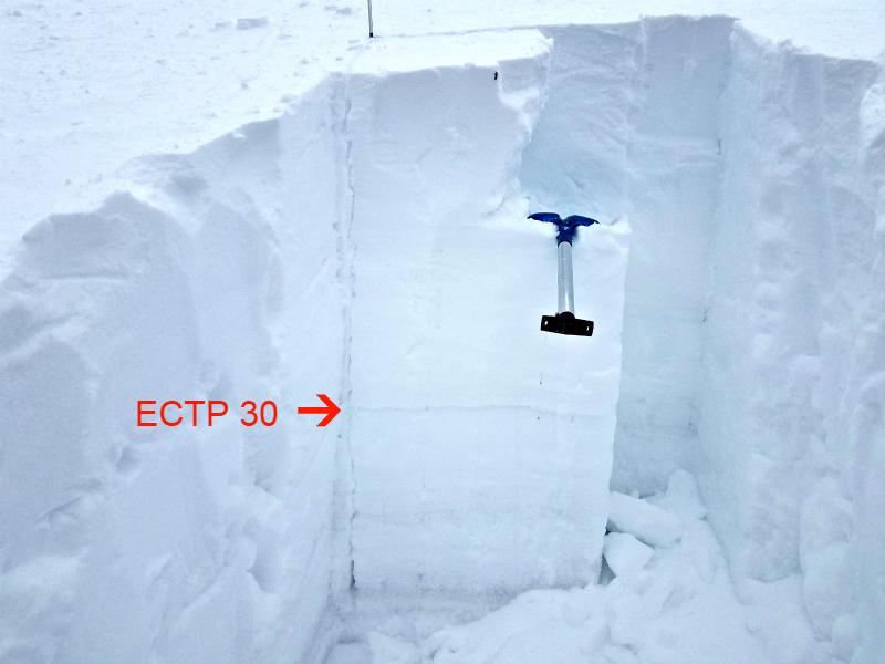
Pit #1 was at 8700 ft elevation on an east facing 25 degree slope with a total snow depth of 62 inches. There was a weak layer about 6 inches from the surface and a thin ice crust a foot from the surface. Multiple other weak layers were identified in the snowpack. Compression tests showed failures of CT16 and CT20 down about 18 inches from the surface. A CT30 failure down about 40 inches and a CT26 failure about 48 inches down. An extended column test was performed and had an ECTN20 failure 18 inches from the surface. A full propagation failure at ECTP30 40 inches from the surface (see pictures 1-3)
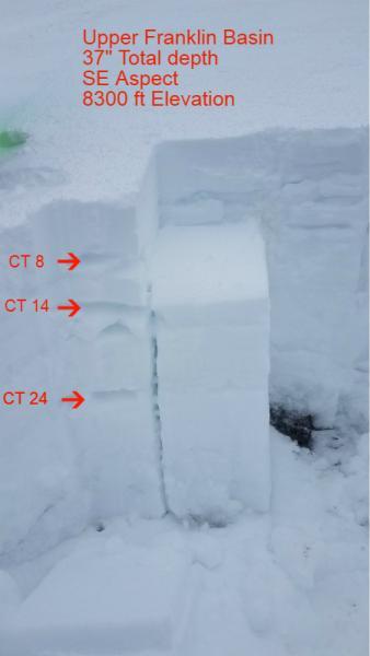
Pit #2 was at 8300 ft elevation on a southeast facing 23 degree slope with a total snow depth of 37 inches. There were weak layers throughout the snowpack with varying rain and grauple layers. Compression test showed failures at CT8, CT14, and CT24. Very clean Q1 shear at the layer 12 inches from the surface was the most concerning. (see picture 4)
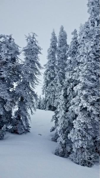
The tops of the mountains were bogged in all day above 8800 feet elevation. The trees had a lot of rime on them but the snow surface seemed unaffected (see picture 5).
The only avalanche activity we saw was on the way up the canyon above the Guinavah-Malibu Campground. Looks like a wet slide ran from 6500 down to 5900 feet on a northwest facing slope. It also looked like there could have been a slab in the lower Wood Camp area (North of Sucy’s Ridge). However we just saw it as we were driving up the canyon and didn’t get a good look to see if it was an actual slide.