Planned Website Outage: The UAC website will be down for maintenance on June 17 from 2:00 - 7:00 PM MT.

Observation Date
1/7/2018
Observer Name
Paradis / Brackelsberg / Caplis
Region
Salt Lake » Big Cottonwood Canyon » Guardsman Pass area
Location Name or Route
Guardsman Pass
Weather
Sky
Clear
Wind Direction
West
Wind Speed
Calm
Weather Comments
Chilly to start the day but warmed quickly. The Heber Valley was under a cloud layer.
Snow Characteristics
New Snow Depth
3"
New Snow Density
Medium
Snow Surface Conditions
Powder
Faceted Loose
Wind Crust
Melt-Freeze Crust
Snow Characteristics Comments

The new snow at least helped make things look better even if it wasn't enough to provide the needed cover. South aspects still had minimal snow and were nearly bare. Where there was snow, some of sunnier aspects developed a crust that now had a dusting of new snow over it.

North aspects held good cold snow, however ample tracks in this area limited the amount of good quality snow available.

We noticed that the new snow had already started the faceting process even though it just stopped snowing yesterday. This could get destroyed in the warm pre-frontal environment prior to the next system this week but I'm not sure.

Red Flags
Red Flags
Cracking
Collapsing
Poor Snowpack Structure
Red Flags Comments
Much like what was demonstrated in Cowboy's video ( https://www.instagram.com/p/Bdl4z0Nnw9T/ ) the current snowpack does not currently have much of a slab but is still very weak. Once we do get snow and a slab, the current structure will produce more avalanche activity. We also noted one collapse and shooting crack. It was in sort of an unsual spot that was on a treed ridge well off the main ridge. Perhaps this area got some wind or sun that allowed more of a slab to form.
Avalanche Problem #1
Problem
Persistent Weak Layer
Trend
Same
Problem #1 Comments

This area had snow from November. I dug a pit on an easterly aspect in this area during mid-December and found a weak crust-facet sandwich. The crusts and facets between them in the old snow have not changed substantially in the last three weeks.

On more northerly, shady aspects the crust was not present and the lower half of the snowpack was entirely facets, which is also concerning.

Snow Profile
Aspect
East
Elevation
9,700'
Slope Angle
29°
Comments

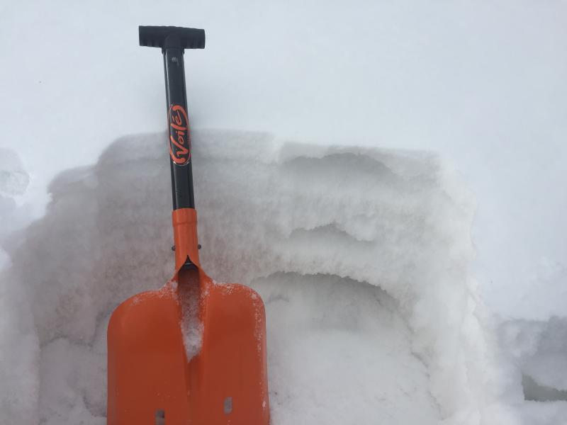
The photo below shows the weak crust - facet combo from mid-December. I was curious to see if this had decomposed or faceted away. It had not. My notes from the time indicated that the weakest snow was near the top of the old snow, about 40 cms above the ground. This is the same layer that produced results today.

Today's Observed Danger Rating
Moderate
Tomorrows Estimated Danger Rating
Moderate
Coordinates